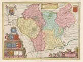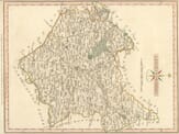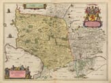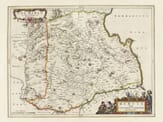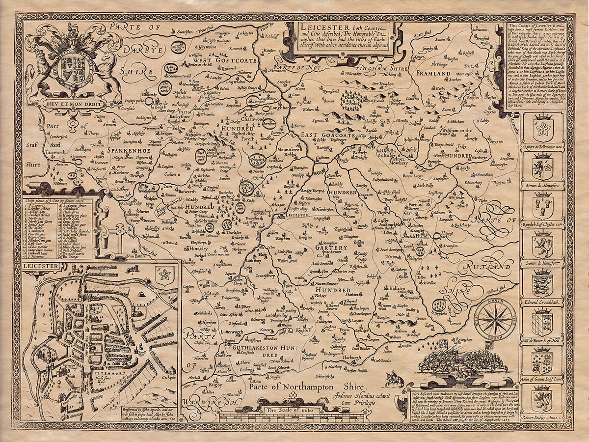

Description
John Speed added a short essay which was published on the rear (the verso) of
the old map of Leicester which we have translated into modern English . . .
A Description of Leicestershire
Leicestershire is bordered to the north by Nottinghamshire, to the east by Lincolnshire and Rutland, to the south by Northamptonshire, and to the west by the Watling Street, which separates it from Warwickshire. The rest of its boundaries are shared with Derbyshire. It is a mostly flat, open country, rich in grain crops but lacking in forests, especially in the southern and eastern parts. These areas are supplied with coal from the north of the county, and there are many cattle raised in the hills beyond the River Wreak, although this area is not as densely populated as the rest of the county.
The climate is mild, gentle, and temperate, promoting good health and long life, with few instances of illness. The people of Carlton, however, have a noticeable accent.
The land produces a variety of goods, including grain, cattle, and coal. Near Bever, precious stones called Astroites (star-shaped stones) are sometimes found in the rocks.
The first people to live here were the Coritani, who spread across other regions. After the Romans left Britain, the area came under the control of the Mercians and their kings, who ruled over it for many years.
The county is nearly circular in shape and not very large. Its widest point from east to west is just under 30 miles, and from north to south it is 24 miles. The total circumference is about 196 miles. The principal city, Leicester, is located almost at the center of the county. It lies at 53 degrees and 4 minutes north latitude and 19 degrees and 22 minutes west longitude.
The city has had several names throughout history, including Legeceftria, Leogora, and Legeo-cefter. It was also known as Caer-Lerion by the Welsh historian Ninius, and as Wiral by Matthew of Westminster. The name Leicester is the most common today. The city is ancient, having been founded by King Leir around 844 BC. According to Geoffrey of Monmouth, Leir also built a temple to Janus and was buried there. However, it is certain that Ethelred, the Mercian king, made Leicester an episcopal see in 680 AD, with Sexwulph becoming the first bishop. Later, the town fell into decline after the bishopric was moved elsewhere.
Lady Edelfled, moved by compassion for the city’s decay, rebuilt the town’s structures and encircled it with a strong wall. The city’s trade grew rapidly, and Matthew Paris wrote that Leicester became a wealthy and well-defended city. If its wall had a solid foundation, it would have rivaled any city in wealth and defense. However, the prosperity did not last, as the Normans brought about a series of calamities. When Robert, the hunchbacked Earl of Leicester, rebelled against King Henry II, Leicester was besieged and the city’s walls were destroyed. The city was set on fire, and many of its citizens were forced to pay large sums to avoid exile, with some taking refuge in the sanctuaries of St. Edmunds and St. Albans.
In remorse for the destruction, Earl Robert founded the Monastery of St. Mary de Pratis, where he became a canon and spent the next 15 years in prayer. Similarly, Henry I, Duke of Lancaster, built a hospital for 110 poor people and a collegiate church, which became one of the city’s greatest landmarks. This was later destroyed by Henry VIII, who closed many similar religious establishments.
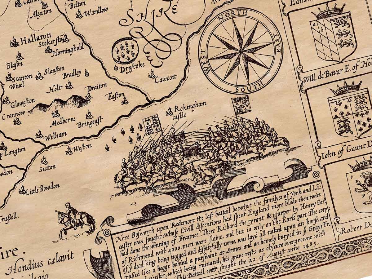
The misfortunes of King Richard III, another hunchbacked ruler, are also tied to Leicester. Richard, after losing the crown in battle to Henry Tudor, was brought back to Leicester in disgrace and buried in the Greyfriars Church. His grave site was later lost, with only a stone chest, now used as a horse trough, remaining to mark the spot of his burial. Similarly, the burial site of Cardinal Wolsey, who had planned a grand monument for himself, is now marked by a simple stone.
Other notable places in the county include Cleycester (now a cross where the Roman city of Bennones once stood), Loughborough in the north, and Redmore near Bosworth, where Richard III lost his life in the Battle of Bosworth Field. The town of Lutterworth is also significant for being the place where John Wycliffe, the famous reformer, preached against the Catholic Church.
Religious houses founded by nobles include Leicester, Grace-Dieu, Kirkby-Bellers, and a hospital for lepers in Burton. The patients there were not only physically afflicted but also spiritually in need of care. These religious foundations were later dissolved, with many of their practices criticized.
Leicestershire is divided into six hundreds and contains 13 market towns, with 200 parish churches. The names of these towns and churches are listed in the following table.