Grenville Sea Chart
Grenville Sea Chart Sea Chart Sea Chart Rochester Area

Antique Sea Chart

Price range: £35.55 through £59.95

Antique Sea Chart of the North Sea by Captain Greenville Collins

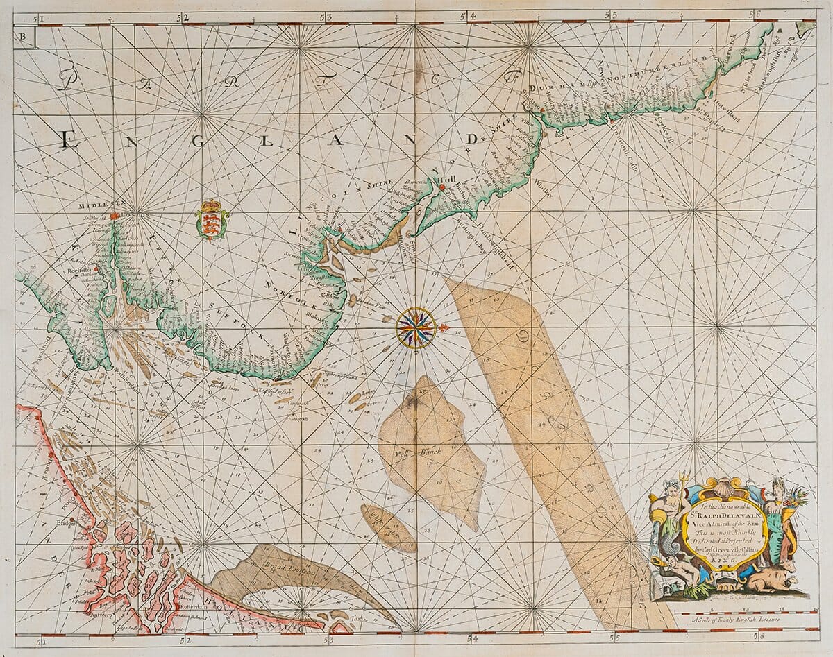
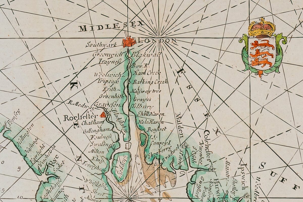
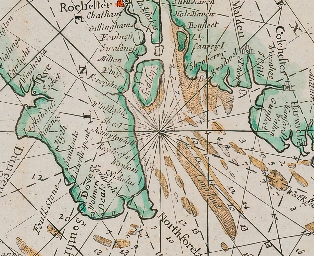
Charles II commissioned Captain Greenvile Collins in 1676 to chart the coasts of Great Britain. The result, his Great Britain’s Coasting Pilot, 1693, was the first original engraved sea-atlas by an Englishman, after Dudley’s Arcano, and covered the whole English coast, part of the east coast of Scotland and selected Irish harbours.  This section covers the area of The North Sea.

  • Stunning giclée fine art print on authentically aged heavy textured paper
  • 12 Colour printing technology  •  Guaranteed to pass or exceed museum quality standards  •  Free UK Courier Delivery with tracking

Available in three sizes: Large: 24″ x 31″ (61 x 78.7cms)   Medium: 18″ x 24″ (45.5 x 61cms) Small: 19.5″ x 14″ (49.5 x 35.5cms)

Additional information

Dimensions N/A
Size

, ,

You may also like…

  • Detail from an old map of GreeceOld Map of GreeceSelect options This product has multiple variants. The options may be chosen on the product page

    Greece

    Price range: £35.55 through £59.95
  • old-map-crete-detailOld Map of CreteSelect options This product has multiple variants. The options may be chosen on the product page

    Crete Greek Islands

    Price range: £35.55 through £59.95
  • Detail from Old Map of Greek IslandsOld Map of Greek IslandsSelect options This product has multiple variants. The options may be chosen on the product page

    Greek Islands

    Price range: £35.55 through £59.95
  • Detail from an old map of CorfuOld Corfu MapSelect options This product has multiple variants. The options may be chosen on the product page

    Corfu – Greece

    Price range: £35.55 through £59.95
×
Product added to cart

No products in the cart.