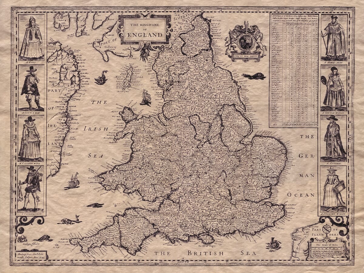
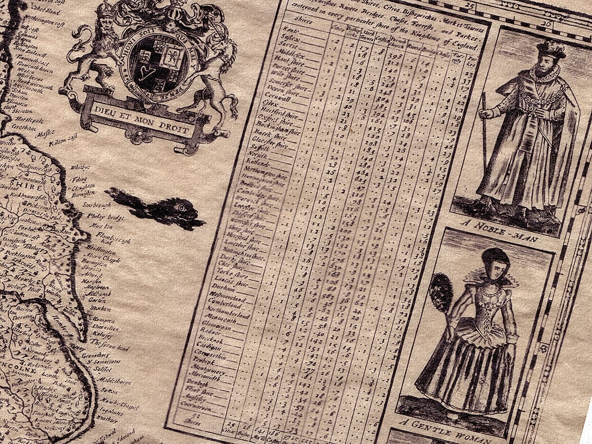
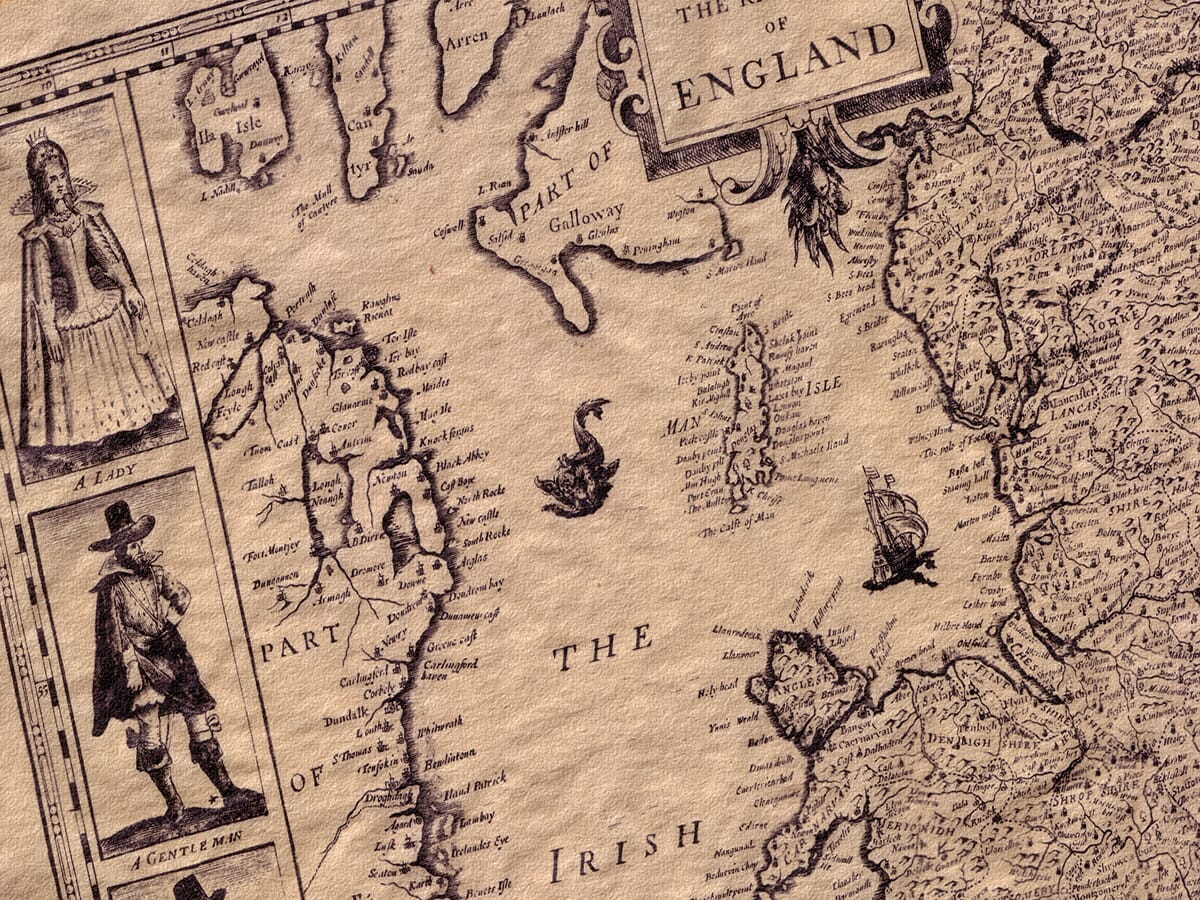
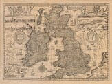
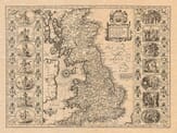
The map of “The Kingdom of England” was based on a plate from Christopher Saxton’s Atlas of 1579. Speede made a number important improvements on Saxton’s work introducing new natural features such as lakes, woods, rivers and towns together with detailed county boundaries. The borders of the map show a series of costumed figures from village people to gentry.
Stunning giclée fine art print on authentically aged heavy textured paper
12 Colour printing technology • Guaranteed to pass or exceed museum quality standards
Bespoke framing service • Free UK Courier Delivery with tracking
Available in three sizes: Large: 24″ x 31″(61 x 78.7cms) Medium: 18″ x 24″(45.5 x 61cms) Small: 19.5″ x 14″ (49.5 x 35.5cms)
A stunning certified FINE ART PRINT on heavy textured art paper — not a poster
Direct from the publisher — no middlemen
Printed in-house in Cornwall
Free UK delivery — international shipping available
Produced to meet — and often exceed — museum-quality standards
Fine Art Map Reproductions – Museum-Quality Printing
Unlike most online offerings, our maps are produced entirely in-house, not outsourced to print-on-demand or drop-shipping services. This allows complete control over quality while offering better value. Each map begins with a high-resolution original, carefully enhanced and printed to order using archival papers and pigment inks for exceptional clarity, depth, and longevity. Every piece is personally overseen — no map leaves our workshop unless it is of a quality we would be proud to display ourselves.
Authentic Old Map Paper & Accurate Colour Reproduction
Paper choice is essential to the authenticity of our maps. We use specially sourced 190gsm paper made in the UK from pure materials and traditionally pressed with natural woollen felts. This process creates a subtle, randomly textured surface that closely resembles an original antique document. Likewise the use of premium quality ink fully saturates the paper, producing remarkable clarity, depth, and historical character. Colour fastness and sharpness will remain good for in excess of 100 years!
Buy Old Maps Online in the UK Today
Trading online since 1999
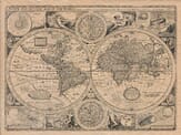
The Old Map Company of Great Britain offers a vast and carefully curated collection of the very finest expertly reproduced vintage maps. Our range includes works by renowned cartographers such as John Speed and Willem Blaeu, covering Scotland, England, and beyond. Free UK courier delivery is included, with EU, USA, and worldwide shipping available at cost and calculated at checkout. If you need assistance, our team is always happy to help you choose the perfect map.
RECENT REVIEWS
M.F. Leicestershire
Very impressed . . . exceeded my expectations. My son would now like one for Christmas!
Julia Ballester
Very pleased with the quality of the map and it even arrived before it was supposed too.
Nikki
Amazed to find the church where we married on a 400 year old map. Bought as a 1st anniversary gift.
K.H. Middlewhich
I am absolutely delighted with the my antique map. It is so interesting. I would now like to purchase another Map for my sister as a Christmas present.
A Thoughtful Gift with a Personal Touch
An antique-style reproduction map from The Old Map Company of Great Britain makes a truly inspired gift—especially for an older loved one.
Take a little time to research a place that holds meaning for them: their birthplace, the town where they married, or even a cherished honeymoon destination. Whether it’s a bustling city or a quiet village, these maps bring history and memory beautifully together.
Not sure where to begin? The Old Map Company is happy to help with your research and can assist in locating the exact town or village you’re looking for.
Every map is printed to the highest standard and is guaranteed to delight—making it a timeless keepsake they’ll treasure for years.