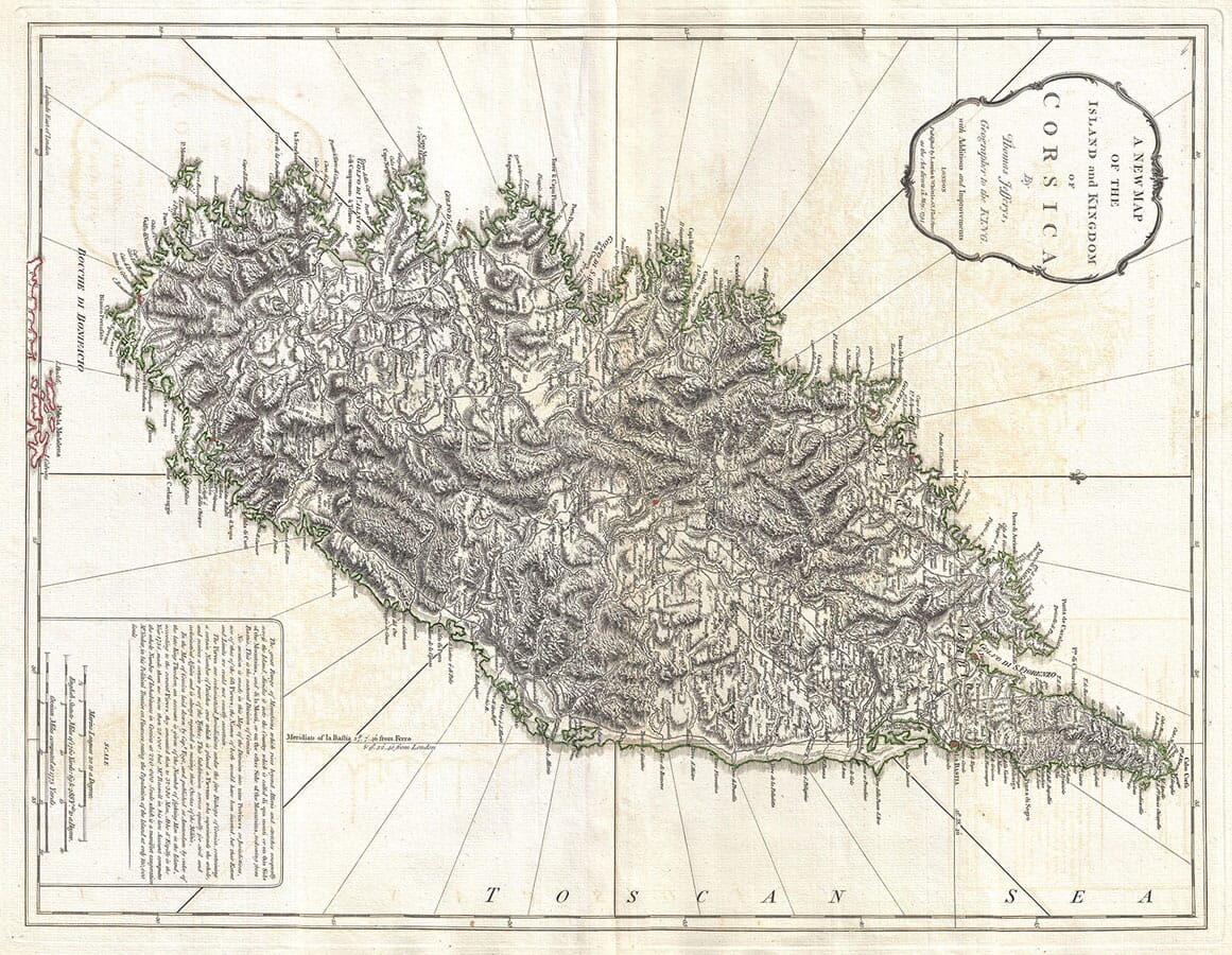
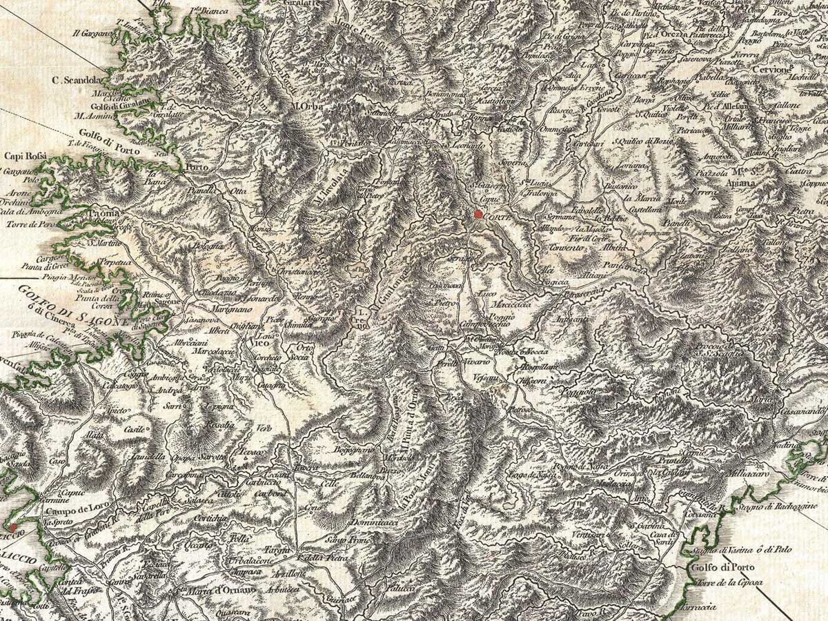
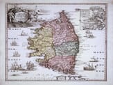
A beautiful map of the island of Corsica. The level of intrinsic detail is remarkable and covers the entirety of this small island. The map offers both topographical and political information to the viewer. Corsica’s blend of dramatic mountains and idyllic beaches are shown and reflect the thought that Corsica is one of the world’s most beautiful places. A small paragraph in the lower right corner of the map discusses the geography and population of the island at that time. Born in Birmingham, Thomas Jefferys was one of the 18th century’s most prominent and renowned cartographers, and this fine map is an undeniable example of this.
Stunning giclée fine art print on authentically aged heavy textured paper
12 Colour printing technology • Guaranteed to pass or exceed museum quality standards
Bespoke framing service • Free UK Courier Delivery with tracking
Available in three sizes: Large: 24″ x 31″(61 x 78.7cms) Medium: 18″ x 24″(45.5 x 61cms) Small: 19.5″ x 14″ (49.5 x 35.5cms)
A stunning certified FINE ART PRINT on heavy textured art paper — not a poster
Direct from the publisher — no middlemen
Printed in-house in Cornwall
Free UK delivery — international shipping available
Produced to meet — and often exceed — museum-quality standards
Fine Art Map Reproductions – Museum-Quality Printing
Unlike most online offerings, our maps are produced entirely in-house, not outsourced to print-on-demand or drop-shipping services. This allows complete control over quality while offering better value. Each map begins with a high-resolution original, carefully enhanced and printed to order using archival papers and pigment inks for exceptional clarity, depth, and longevity. Every piece is personally overseen — no map leaves our workshop unless it is of a quality we would be proud to display ourselves.
Authentic Old Map Paper & Accurate Colour Reproduction
Paper choice is essential to the authenticity of our maps. We use specially sourced 190gsm paper made in the UK from pure materials and traditionally pressed with natural woollen felts. This process creates a subtle, randomly textured surface that closely resembles an original antique document. Likewise the use of premium quality ink fully saturates the paper, producing remarkable clarity, depth, and historical character. Colour fastness and sharpness will remain good for in excess of 100 years!
Buy Old Maps Online in the UK Today
Trading online since 1999
The Old Map Company of Great Britain offers a vast and carefully curated collection of the very finest expertly reproduced vintage maps. Our range includes works by renowned cartographers such as John Speed and Willem Blaeu, covering Scotland, England, and beyond. Free UK courier delivery is included, with EU, USA, and worldwide shipping available at cost and calculated at checkout. If you need assistance, our team is always happy to help you choose the perfect map.
RECENT REVIEWS
M.F. Leicestershire
Very impressed . . . exceeded my expectations. My son would now like one for Christmas!
Julia Ballester
Very pleased with the quality of the map and it even arrived before it was supposed too.
Nikki
Amazed to find the church where we married on a 400 year old map. Bought as a 1st anniversary gift.
K.H. Middlewhich
I am absolutely delighted with the my antique map. It is so interesting. I would now like to purchase another Map for my sister as a Christmas present.