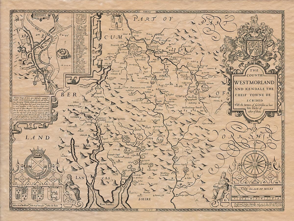
Westmorland, according to some late Latin writers, is referred to as Weftmaria, Westmorlandia, and by even later writers as Weftmoria. In English, it is simply called Westmorland. The name originates from the region’s geography, which is abundant in moors and high hills stretching from one area to another, making Westmorland a western “moorish” country. It is bordered by Cumberland to the west and north, Lancashire to the south, Yorkshire to the east, and the Bishopric of Durham.
The length of Westmorland, from Burton in the south to Kirkland in the north, is 30 miles. Its widest part, from east to west, stretches from the River Eden to Dunbalrafe stones, covering 24 miles. The total circumference of the region is about 112 miles.
The land’s shape is somewhat long and narrow. The air is sharp and piercing, which helps clear away heavy fogs and vapors. Because of this, the people of this area do not suffer from many of the strange diseases or health problems common elsewhere. They tend to live long, healthy lives, reaching old age.
For the most part, the soil in Westmorland is barren and not easily made fertile, even with the hard work of farmers. There are many infertile areas, referred to as moors by the northern English. However, the more southern part of the region is not as barren and is more productive, especially in the valleys between the River Lune and Windermere. This part is known as the Barony of Kendale (or Candale), named after the River Can that flows through it.
The ancient inhabitants of this land were the Brigantes, who also lived in parts of Yorkshire, Lancashire, and Cumberland.
Westmorland is not known for an abundance of crops or livestock, as it lacks arable land for growing crops or pastures for raising animals. The main industry for the people of this region is cloth-making.
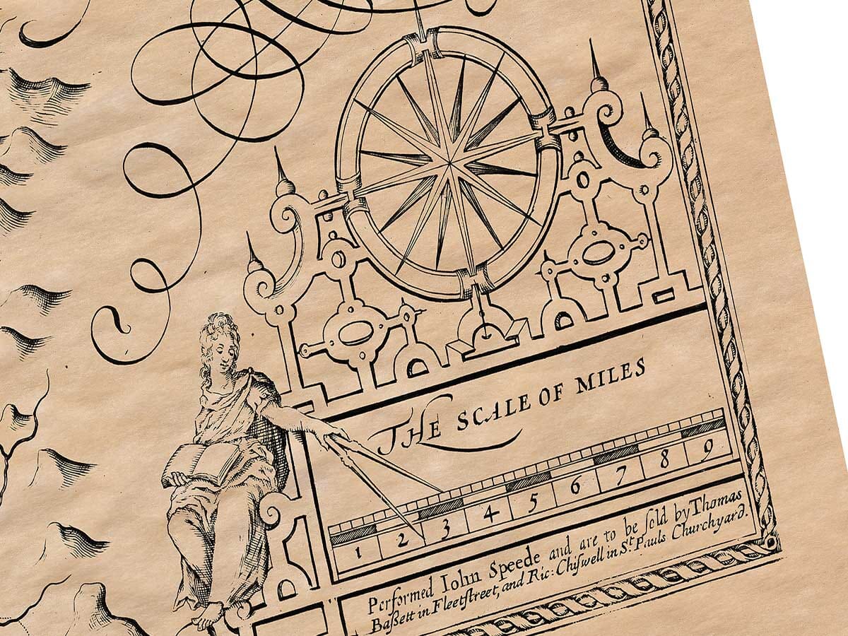
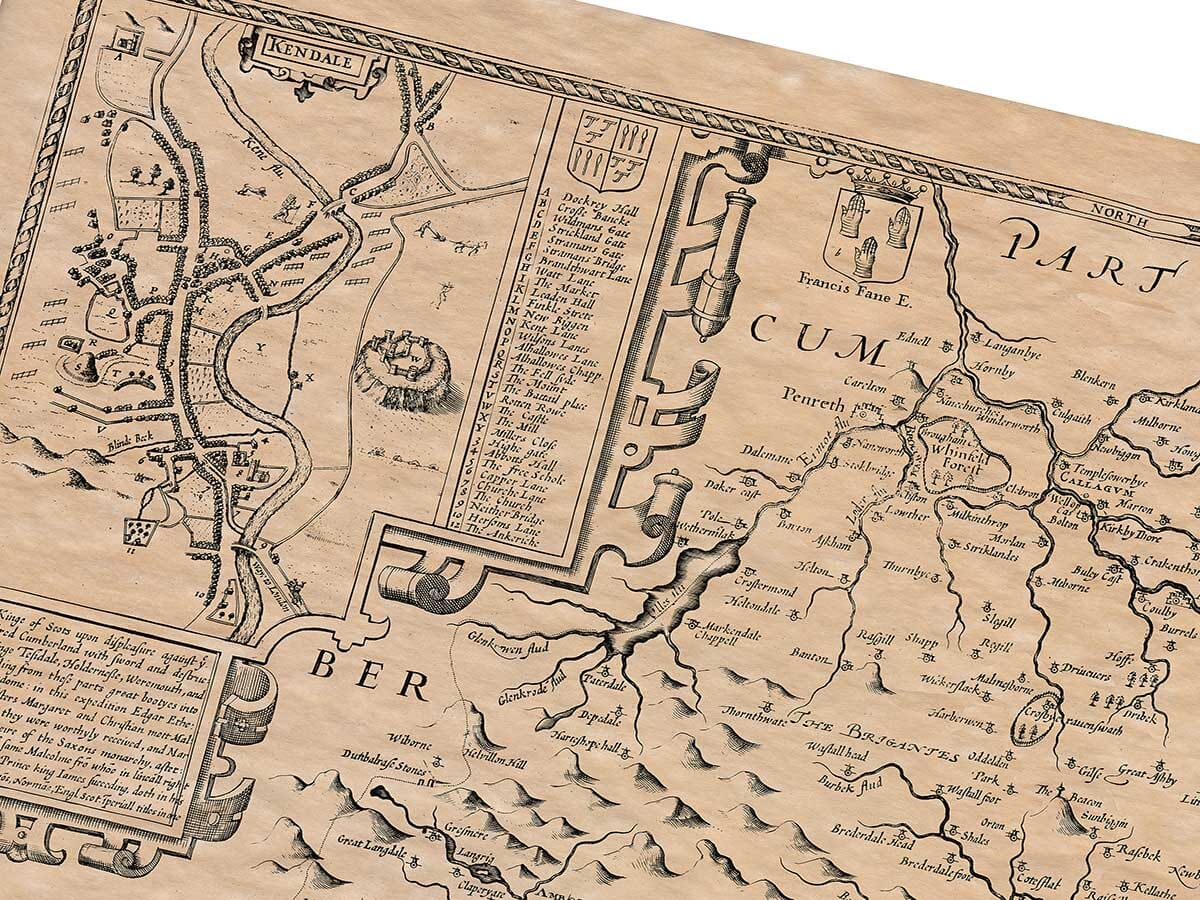
The most significant town in the region is Kendale (also known as Kirkby Kendale), situated on the banks of the River Can. This town is a center of trade and industry, especially known for its cloth production. Its cloth-making expertise has earned it a reputation throughout England, and it enjoys a high level of commerce for its woolen goods. Although not very old, Kendale prides itself on having elevated three Earls to the title, including John, Duke of Bedford, John, Duke of Somerset, and John de Foiz, who were honored for their services in the French Wars. The town is known for its good governance, led by an Alderman chosen annually from a group of twelve members. The Alderman and his senior colleague serve as Justices of the Peace. Other officials include a Town Clerk, a Recorder, two Sergeants at Mace, and two Chamberlains. The town’s location is recorded as being at 17 degrees and 30 minutes longitude, and 55 degrees and 15 minutes latitude.
Places of historical significance include Vertere (now known as Burgh under Stanemore) and Aballaba (now known as Appleby). Vertere was a station for a Roman captain during the later days of the Roman Empire, and Appleby was the site of a northern English conspiracy against William the Conqueror. Roman ruins and coins have been found around these areas, suggesting their long history. Appleby, once a bustling town, is now largely deserted, with its castle used primarily for the Assizes.
There is only one religious house noted in Westmorland, a small monastery near the River Lode, built by Thomas, son of Gospatrick, and his father Orms. This site is also notable for a spring that ebbs and flows multiple times a day. Ancient stones in pyramid shapes, some as high as nine feet and fourteen feet thick, are arranged in a row, possibly in memory of an event, though the details of this are lost to time.
Another notable location is Amboglana (now Amble-side), near Windermere, which shows signs of an ancient Roman city. The remains of Roman roads and fortifications suggest the area’s Roman heritage. Near Kendale, the River Can has two notable waterfalls, known for their loud, forceful falls. The local people use the sound of the waterfalls as a weather forecast: when the northern waterfall sounds clearer and louder, fair weather is expected, but when the southern one echoes similarly, fog and rain are anticipated.
Westmorland has eight market towns, seven castles, and 26 parishes where divine services are held.
John Speed
Above: John Speed added a short essay which was published on the rear (the verso) of
the old map of Northumberland which we have translated into modern English.