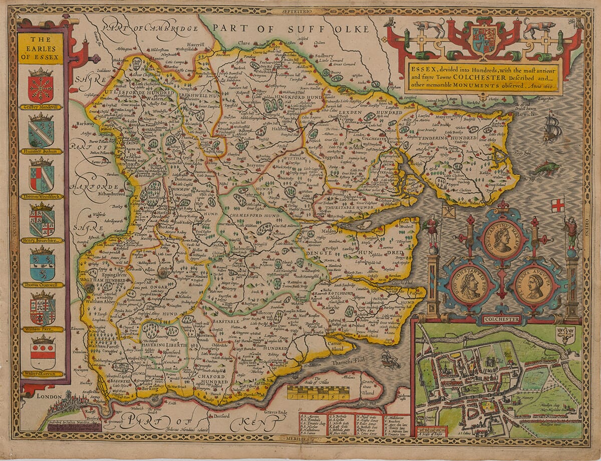
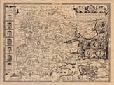
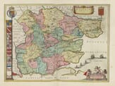
This is a richly decorated early-17th-century county map of Essex (England) typical of John Speed’s work that transformed maps into a piece of storytelling and status as well as an aid to navigation. It’s laid out to show the county’s “Hundreds” (old administrative districts), major towns, rivers, woods, and coastline, with lots of extra historical flair around the edge
Stunning giclée fine art print on authentically aged heavy textured paper
12 Colour printing technology • Guaranteed to pass or exceed museum quality standards • Free UK Courier Delivery with tracking
Available in two sizes: Large: 24″ x 31″(78.7 x 61cms) Medium: 18″ x 24″(45.5 x 61cms) Small: 19.5″ x 14″ (49.5 x 35.5cms)
A stunning certified FINE ART PRINT on heavy textured art paper — not a poster
Direct from the publisher — no middlemen
Printed in-house in Cornwall
Free UK delivery — international shipping available
Produced to meet — and often exceed — museum-quality standards
Fine Art Map Reproductions – Museum-Quality Printing
Unlike most online offerings, our maps are produced entirely in-house, not outsourced to print-on-demand or drop-shipping services. This allows complete control over quality while offering better value. Each map begins with a high-resolution original, carefully enhanced and printed to order using archival papers and pigment inks for exceptional clarity, depth, and longevity. Every piece is personally overseen — no map leaves our workshop unless it is of a quality we would be proud to display ourselves.
Authentic Old Map Paper & Accurate Colour Reproduction
Paper choice is essential to the authenticity of our maps. We use specially sourced 190gsm paper made in the UK from pure materials and traditionally pressed with natural woollen felts. This process creates a subtle, randomly textured surface that closely resembles an original antique document. Likewise the use of premium quality ink fully saturates the paper, producing remarkable clarity, depth, and historical character. Colour fastness and sharpness will remain good for in excess of 100 years!
Buy Old Maps Online in the UK Today
Trading online since 1999
The Old Map Company of Great Britain offers a vast and carefully curated collection of the very finest expertly reproduced vintage maps. Our range includes works by renowned cartographers such as John Speed and Willem Blaeu, covering Scotland, England, and beyond. Free UK courier delivery is included, with EU, USA, and worldwide shipping available at cost and calculated at checkout. If you need assistance, our team is always happy to help you choose the perfect map.
RECENT REVIEWS
M.F. Leicestershire
Very impressed . . . exceeded my expectations. My son would now like one for Christmas!
Julia Ballester
Very pleased with the quality of the map and it even arrived before it was supposed too.
Nikki
Amazed to find the church where we married on a 400 year old map. Bought as a 1st anniversary gift.
K.H. Middlewhich
I am absolutely delighted with the my antique map. It is so interesting. I would now like to purchase another Map for my sister as a Christmas present.
Here are some especially interesting details that feature within this vintage map:
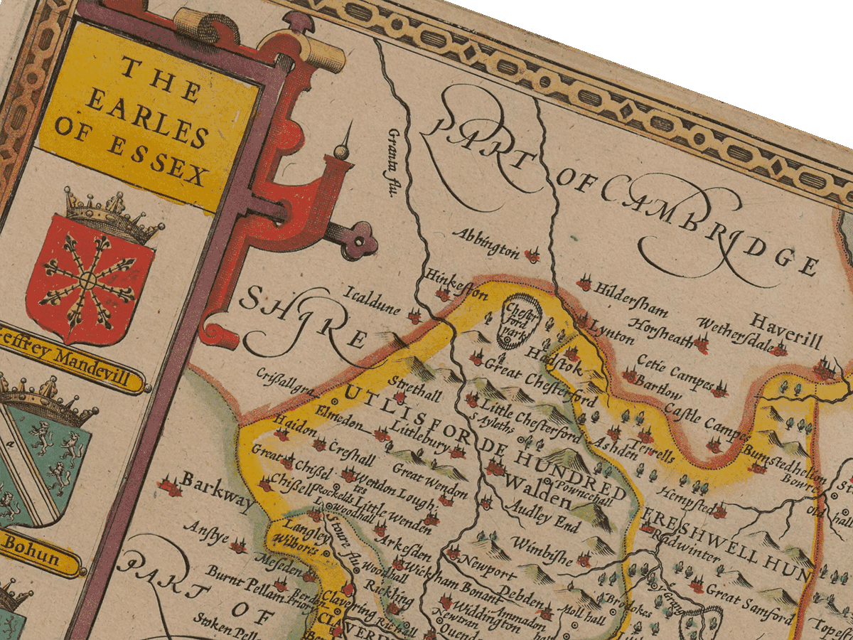
It’s “Divided into Hundreds” (the internal patchwork): across the map and you’ll see district names ending in “Hund.” / “Hundred” (e.g., Barstable Hundred, Chafford Hundred, Dengie Hundred). Those fine boundary lines are showing how Essex was governed locally long before modern councils.
The title cartouche on the top right is in itself a work of art and reads: “ESSEX, divided into Hundreds… with the… Towne COLCHESTER described… Anno 1610.”
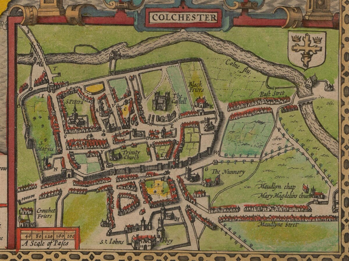
Bottom-right is a detailed plan of Colchester, with key buildings picked out (you can spot the Castle as a dark blocky structure) and lots of street labels. Beneath it are indexed lists and even “A Scale of Pases” (paces) a unit of measurement derived from the Latin mille passuum (a thousand paces), which is the origin of the modern mile. A pass was typically defined as 5 feet.
Above the Colchester town plan are three coin-like portraits labelled for Constantine, Constantius, and Helena (you can read “HELENA AVG” on one). Colchester (Roman Camulodunum) was often wrapped in Roman and medieval origin stories, and these medallions are John Speed’s way of portraying that this place is old, important, and imperial.
The “Earles of Essex” panel down the left side reflects county pride and is a vertical gallery of coats of arms with names, essentially a mini genealogy / honour roll of the earldom. Maps like this become history lessons and reflect the political gesturing of the age.
An intricate London cameo features at the bottom-left. The sea is not empty, off the east coast there’s a sailing ship and a sea creature. Early maps often filled oceans with motion and menace: it added life, and it made the coastline feel like a real place of adventure the famous Carta Marina map being a classic example.
And finally a scale bar sitting on a sandbank near the Thames estuary the “Scale of Miles” is printed on a pale island-like shape labelled put the scale where it wouldn’t cover important land details, and also shows that the inclusion of sandbanks mattered for navigation.