John Speed added a short essay which was published on the rear (the verso) of
the map which we have translated into modern English . . .
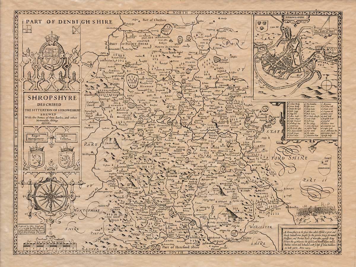
(1) Shropshire, which was called “Sclypyrice” by the ancient Saxons, is large in size, well-populated, and very fertile. It is located to the north with the County Palatine of Chester, to the east with Staffordshire, and to the south with Worcestershire, Herefordshire, Radnorshire, and Denbighshire. It stretches to the west with Montgomery and Denbighshire.
(2) The shape of the county is nearly circular or round, with its total length from Wroxeter (modern Shrewsbury) to Ludlow in the south and reaching over to the River Trent in the north, about thirty-four miles. The broadest part is from Long in the east to Oswestry in the west, about twenty-five miles. The entire area measures one hundred and four miles.
(3) The land is rich, fertile, and good for farming, with springs and autumn harvests. The soil is suitable for agriculture, providing sustenance for the local population in all seasons.
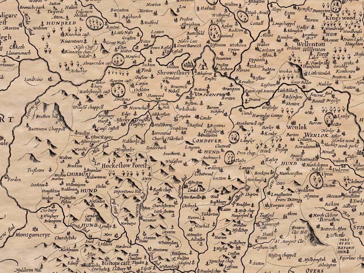
(4) The soil is also well-suited for grazing livestock such as cattle, which thrive on it. The county has rivers, including the Severn, which provide abundant water for agriculture. The county is covered in forests, with many areas still in their natural state.
(5) The Severn River runs along the northern boundary of the county, dividing it from the land of the Saxons. In ancient times, the river began to dry up, and the Welsh people extended their settlements and opened up the land for farming.
(6) When the Romans arrived, they expanded their control over the area. The Cornovii were the main tribe in this region, and they reached out to other parts of Britain. Afterward, the Saxons began to settle in the land, and the Kingdom of Mercia was formed.
(7) This county was once ruled by King Henry I, who also ruled Wales. He promoted the city of Shrewsbury, which grew in prominence during his reign, and was a center of trade, industry, and wealth. King Henry VIII later established councils in the area to govern it more effectively.
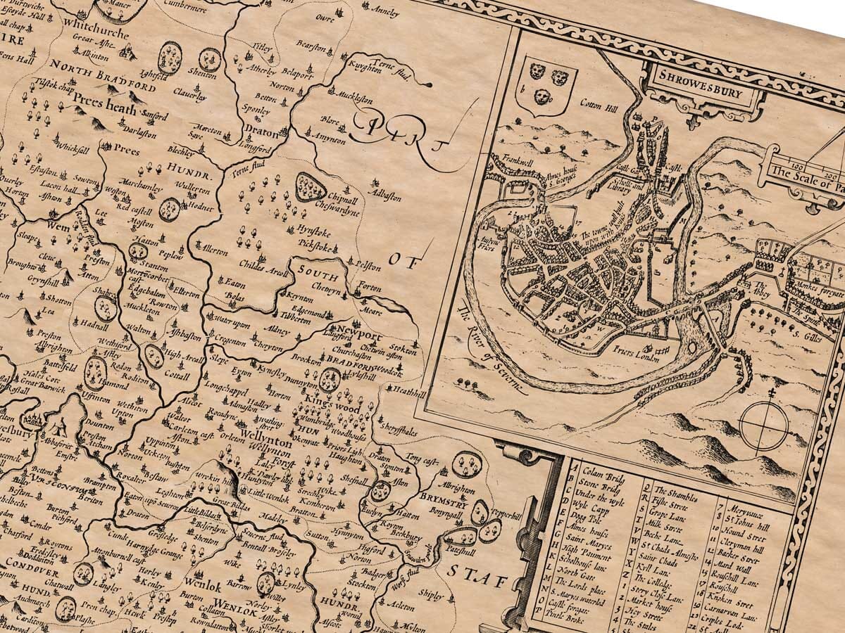
(8) The capital of the region, Shrewsbury, is the most important town, which is known for its wealth and prosperity. The town was also a strategic location with its proximity to Wales. The town is governed by two bailiffs, a recorder, a town clerk, and other officials.
(9) Several ancient towns have been in the area since Roman times, including the cities of Wroxeter and Uriconium, where the remains of Roman settlements can still be found.
(10) Shropshire is divided into one hundred and sixteen hundreds, with sixteen market towns, and a large number of rural villages. The county has several industries, including agriculture, trade, and metalwork, particularly iron and copper.