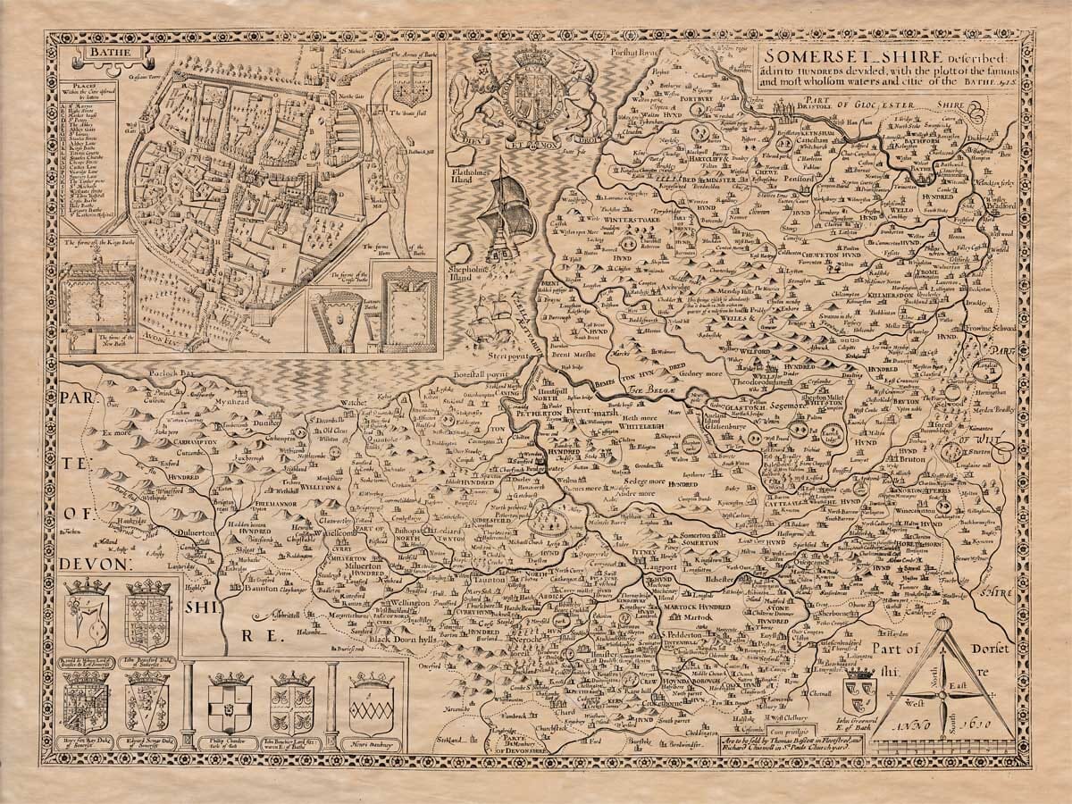
Somersetshire is a rich and spacious county, bordered by the Severn Sea to the north, Devon and Dorset to the south, Devonshire to the west, and Wiltshire and Gloucestershire to the east and northeast. It took its name from the town of Somerton (once the chief town in the shire), which is why the ancient historian Asserius called this county “Somertunensis,” or Somersetshire.
-
The northern part is large and extends in length from Brackley near Frome Selwood, eastward to Oare in the west, about 55 miles. From Porlock Point in the north to Chard in the south, it’s just over 40 miles. The total circumference is about 204 miles.
-
The air is mild and pleasant, and during summer, the climate is so temperate that some have thought the name “Somerset” comes from the nature of its climate—meaning it is always like summer. When the season changes to fall, it becomes even more pleasant and milder, and when it’s winter, it borrows a spring-like name, being full of west winds, fog, and moisture. It is often so wet that locals can hardly travel due to constant rainfall.
-
Despite this, the soil is fertile and produces much grain, especially barley. The land is adorned with estates, pleasant meadows, and fine buildings, which make it a great place to live. There’s a saying:
“What is worst for the rider is best for the adder,” meaning that what may be hard to travel on is still rich in soil and pasture.
-
The first known inhabitants were the Belgae, who spread far across Wiltshire and the inner parts of Hampshire. They came from Germany and brought their customs with them.
-
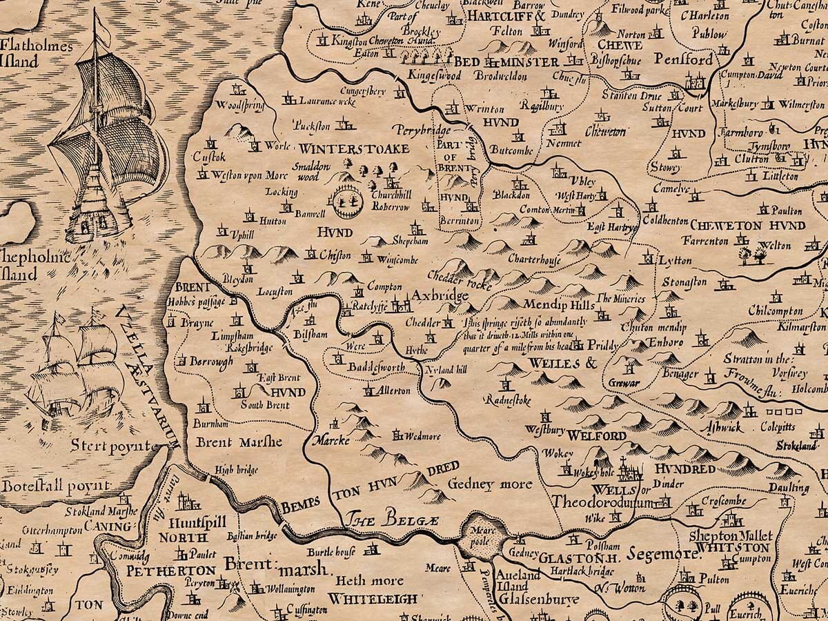
The general produce includes corn and cattle, produced in such abundance that it rivals other counties. The region is rich in lead, especially at places like Mendip Hills, which yield excellent lead for export. There are also diamonds at St. Vincent’s Rock, which shine so brightly they could match real diamonds.
-
The county is famous for its hot baths, especially Bath, which the Romans called Aquae Solis (“Waters of the Sun”). The baths are used to heal various illnesses due to the mineral and sulfur-rich springs. Roman inscriptions and ancient images have been found on the walls of the baths.
-
The town of Wells is also ancient, known for its church dedicated to St. Andrew and the Fountain Church, built by King Ina.
-
Somerset has been the site of many battles. In 986, Portlock was attacked by Danes. Notable battles happened at Pen, North Cadbury, Bridgewater, and Cadbury, where King Arthur is said to have defeated Saxons and Danes. Some believe he was buried in Avalon, now Glastonbury.
-
Many religious sites are found here, including Black Chanons of Barlich, Abelstan’s monastery, and Glastonbury Abbey, said to be founded by Joseph of Arimathea.
-
Camelot, the legendary site of King Arthur’s castle, is believed by some to be in this region, possibly Cadbury Castle. When the Normans came, they made it a borough with 107 burgesses. Remains of Roman and Arthurian structures are often found here.