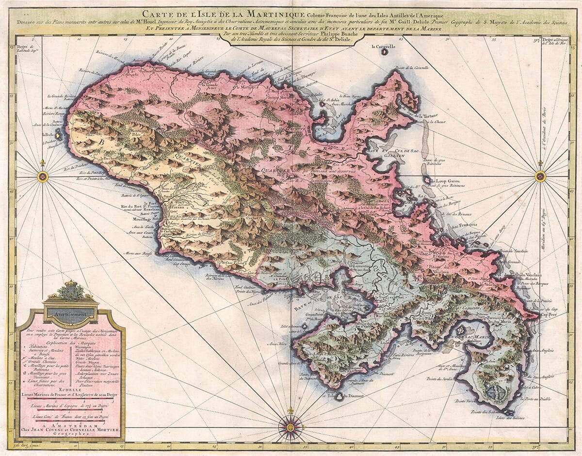
Description
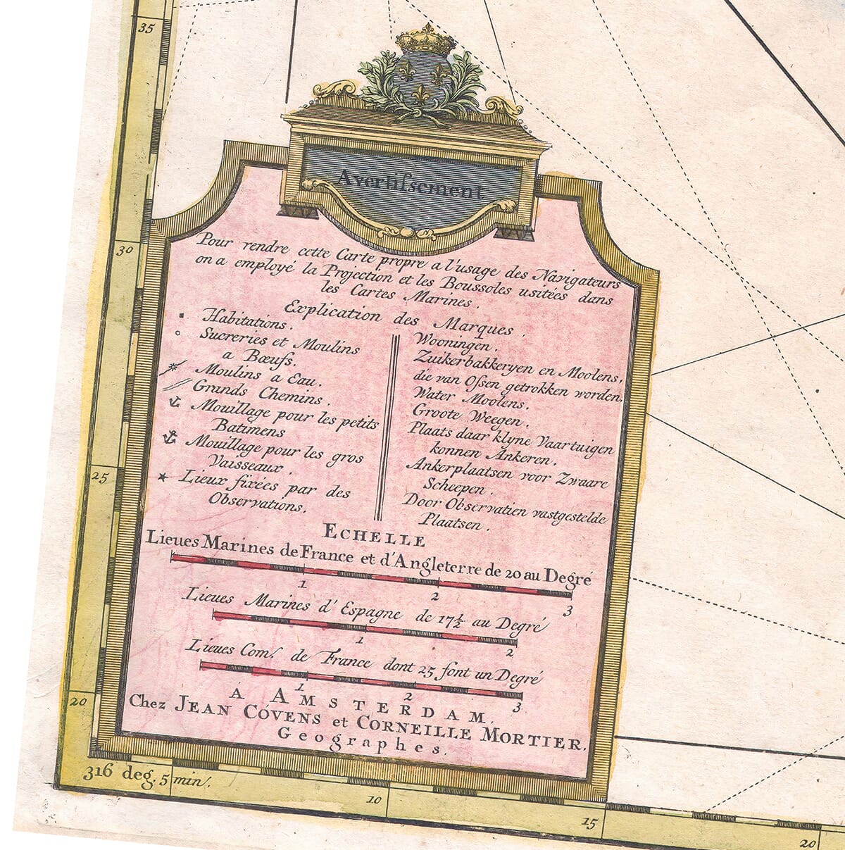
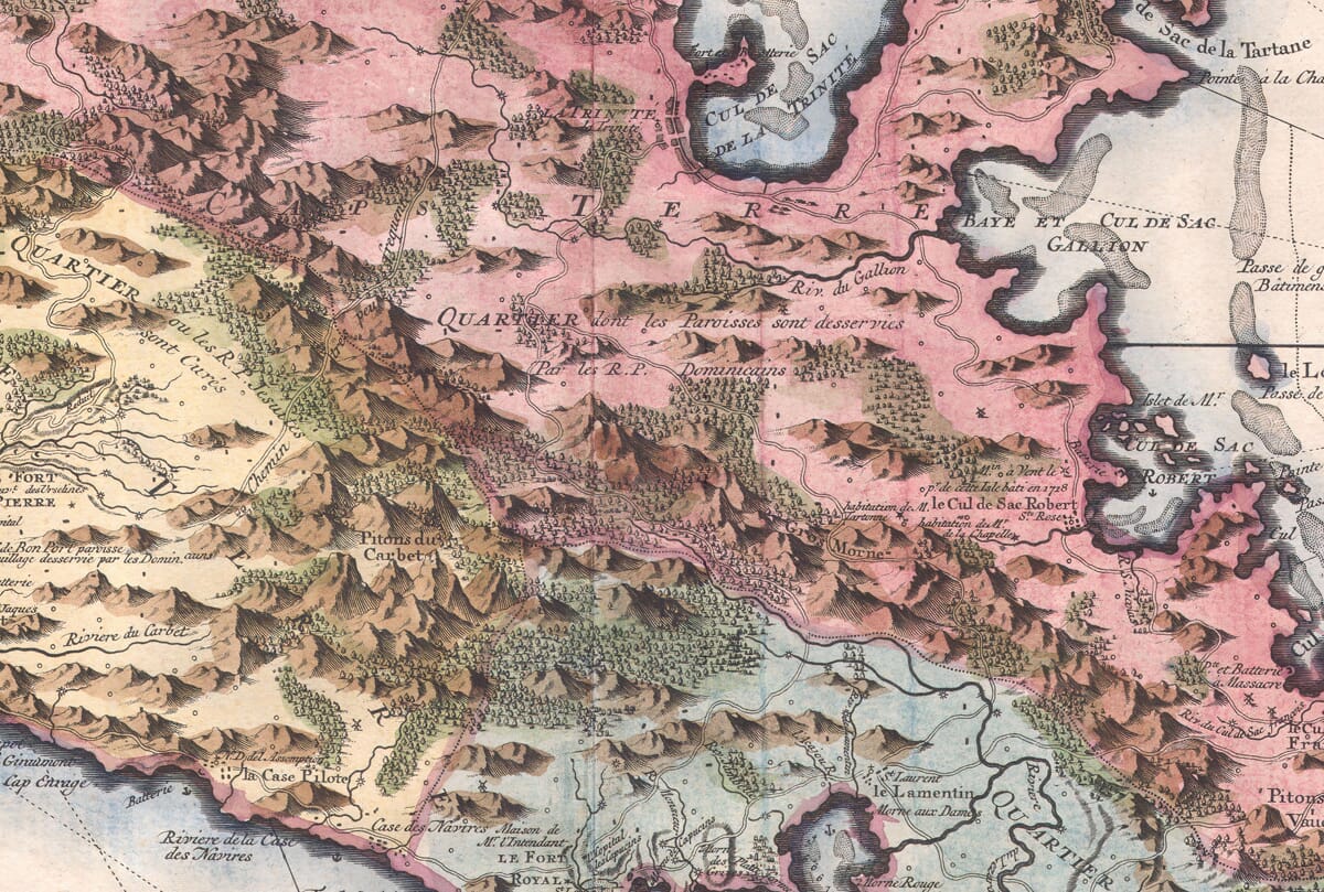
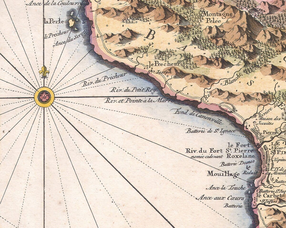
A striking example of Covens & Mortier’s 1742 map of the French colony of Martinique in the West Indies, this finely detailed piece exemplifies the high standards of 18th-century Dutch cartography. The island is shown divided into three principal regions—two in the south and one in the north—with meticulous attention given to both political boundaries and topographical features. Vivid hand-coloring enhances the map’s visual appeal and legibility.
This map draws heavily from the influential work of renowned French cartographers Guillaume De L’Isle (1675–1726) and Philippe Buache (1700–1773), both pivotal figures in the development of scientific cartography. De L’Isle was known for his commitment to accuracy, and Buache, his successor and son-in-law, furthered his legacy through innovative geographical models.
The map was published in the Atlas Nouveau by Covens & Mortier, a prominent Dutch publishing house based in Amsterdam. Founded in the early 18th century, the firm was a continuation of the legacy of Pierre Mortier and became one of the most important map publishers in Europe. Johannes Covens I partnered with Cornelis Mortier to produce atlases that combined French geographical expertise with Dutch engraving and publishing craftsmanship. Their works, often adaptations or translations of leading French maps, made cutting-edge geographic knowledge accessible to a broader European audience. This Martinique map, issued in their 1742 atlas, is a testament to their role in disseminating Enlightenment-era geographic understanding.