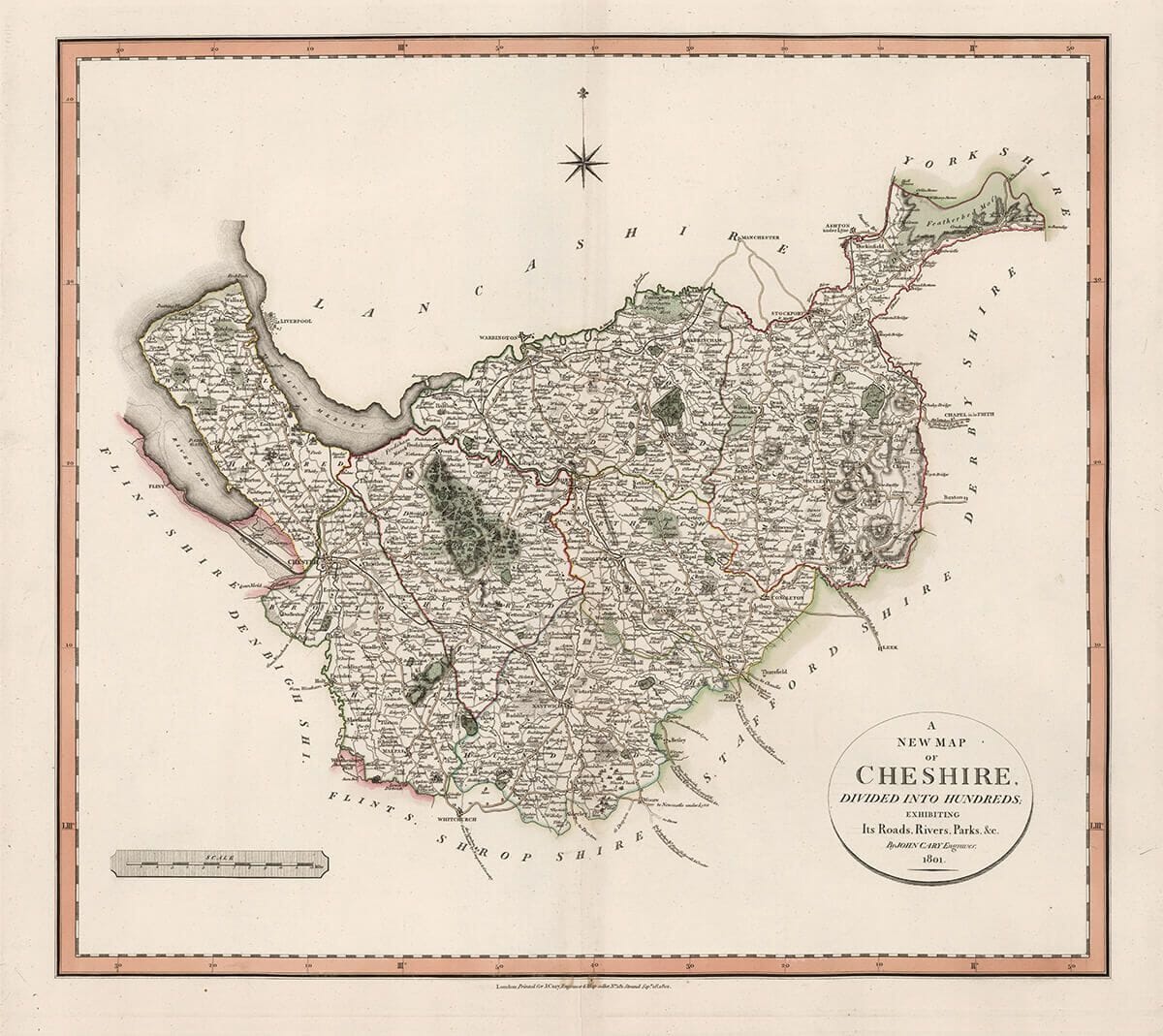
Depicted on the map as a maritime county. During the Saxon heptarchy, it belonged to the kingdom of Mercia; and William the Conqueror made it a county palatine, granting it peculiar privileges, such as having its own judge for all criminal cases, a court of exchequer, etc. It is included in the province of York, and had a diocese of its own name.
Stunning giclée fine art print on authentically aged heavy textured paper
12 Colour printing technology • Guaranteed to pass or exceed museum quality standards
Money Back Guarantee if you are less than delighted with your map
Available in two sizes: Large: 24″ x 25″(61 x 63.7cms) Medium: 18″ x 20″(46 x 51cms)
A stunning certified FINE ART PRINT on heavy textured art paper — not a poster
Direct from the publisher — no middlemen
Printed in-house in Cornwall
Free UK delivery — international shipping available
Produced to meet — and often exceed — museum-quality standards
Fine Art Map Reproductions – Museum-Quality Printing
Unlike most online offerings, our maps are produced entirely in-house, not outsourced to print-on-demand or drop-shipping services. This allows complete control over quality while offering better value. Each map begins with a high-resolution original, carefully enhanced and printed to order using archival papers and pigment inks for exceptional clarity, depth, and longevity. Every piece is personally overseen — no map leaves our workshop unless it is of a quality we would be proud to display ourselves.
Authentic Old Map Paper & Accurate Colour Reproduction
Paper choice is essential to the authenticity of our maps. We use specially sourced 190gsm paper made in the UK from pure materials and traditionally pressed with natural woollen felts. This process creates a subtle, randomly textured surface that closely resembles an original antique document. Likewise the use of premium quality ink fully saturates the paper, producing remarkable clarity, depth, and historical character. Colour fastness and sharpness will remain good for in excess of 100 years!
Buy Old Maps Online in the UK Today
Trading online since 1999
The Old Map Company of Great Britain offers a vast and carefully curated collection of the very finest expertly reproduced vintage maps. Our range includes works by renowned cartographers such as John Speed and Willem Blaeu, covering Scotland, England, and beyond. Free UK courier delivery is included, with EU, USA, and worldwide shipping available at cost and calculated at checkout. If you need assistance, our team is always happy to help you choose the perfect map.
RECENT REVIEWS
M.F. Leicestershire
Very impressed . . . exceeded my expectations. My son would now like one for Christmas!
Julia Ballester
Very pleased with the quality of the map and it even arrived before it was supposed too.
Nikki
Amazed to find the church where we married on a 400 year old map. Bought as a 1st anniversary gift.
K.H. Middlewhich
I am absolutely delighted with the my antique map. It is so interesting. I would now like to purchase another Map for my sister as a Christmas present.
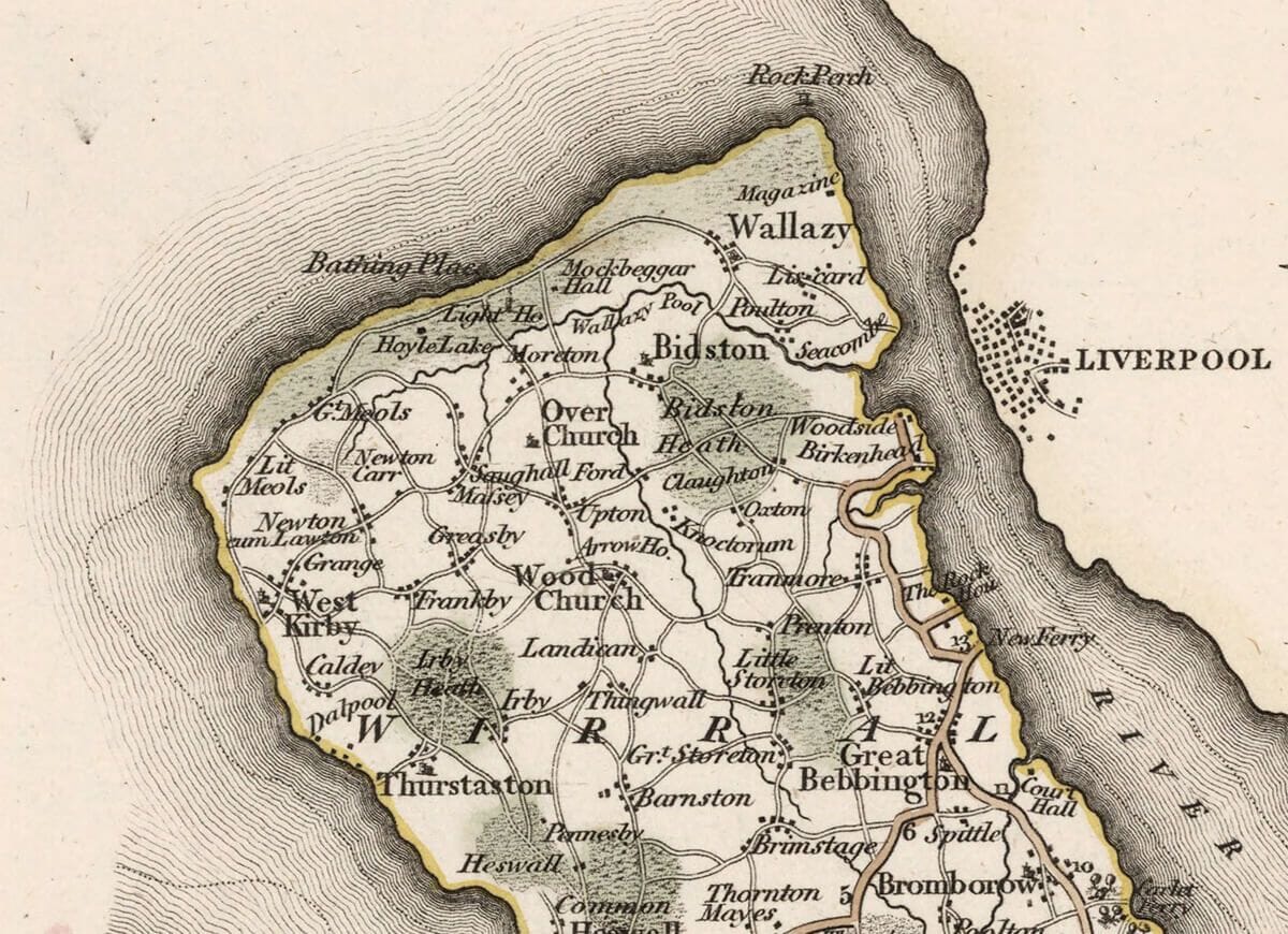
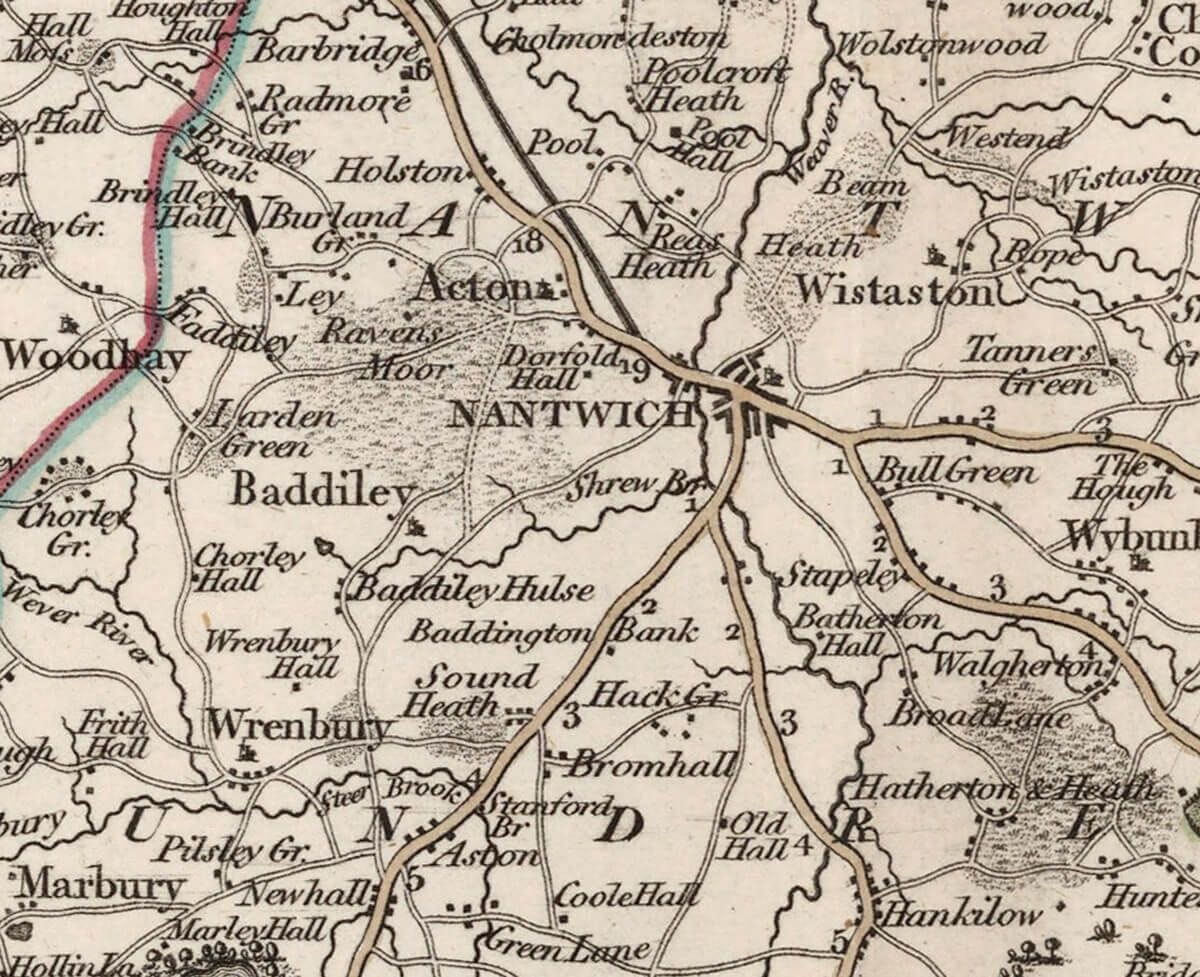
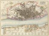
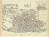
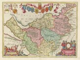
The accompanying notes contained in John Cary’s atlas continue: It is 50 miles long from east to west, 33 miles broad from north to south, and 200 miles in circumference; containing 1050 square miles, or 672,000 square acres; divided into 7 hundreds, 101 parishes, 20 vicarages, 670 villages, one city, Chester, which is a bishop’s fee, and gives the title of Earl to the Prince of Wales, as eldest son of the King of England, first conferred in 1247 by Henry III. It sends 2 members to parliament. It has 11 market towns, viz. Nantwich, which gives the title of Viscount to the family of Cholmondeley; Macclesfield, which gives the title of Earl to the family of Parker; Malpas, which gives the title of Viscount to the family of Cholmondeley; Middlewich, Northwich, Congleton, Altrincham, Frodsham, Knutsford, Stockport, and Sandbach. Among the villages, Kinderton gives the title of Baron to the family of Vernon; Cholmondeley, those of Earl and Baron to the noble family of that name; Dutton, that of Baron to the family of Hamilton; Eaton, that of Baron to the family of Grosvenor. The principal rivers all clearly depicted within the old map in this county are the Mersey, Dee, Weelock, Croke, Dan, Fulbrock, Weaver, Goyte, Bolling, and Ringway. It sends 4 members to parliament, 2 for the county, and 2 for Chester as mentioned before; pays 7 parts of the land tax, and provides 560 men to the national militia. On the coast is the Isle of Hilbre, with Black Rock, Barbo, Dove, and Hyle Sands, with Bugg Wharf, and Middle and High Lake; also Warren Bay, with the entrances of the Mersey and Dee Rivers, and a peninsula between both. It enjoys the most extensive and beneficial inland navigation in the kingdom, with the Duke of Bridgewater’s navigation deserving particular attention. Among the other remarkable places are Moncop, Frodsham, Alderney, and Shutling Hills; the forests of Delamere and Macclesfield; with several lakes, meers, pools, heaths, and mosses. It produces excellent cheese, cattle, corn, coal, iron, millstones, timber, an immense quantity of fine salt, alum, hops, etc. The soil is rich and fertile.
The following are the most remarkable seats:
Addington Hall, near Macclesfield
Ashton Hall, near Frodsham
Capesthorne
Cholmondeley, near Malpas
Crewe Hall, near Sandbach
Davenport Hall
Eaton
Henbury Hall, near Macclesfield
Lower Tabley, near Knutsford
Lyme Park, near Disley
Marbury Hall, near Budworth
Mere Hall, near Knutsford
Motham St. Andrew, near Stockport
Oulton Hall, near Tarporley
Poynton, near Stockport
The most remarkable situations for beautiful and extensive views are:
Delamere Forest, northeast of Chester, Goit Vale, Disley Hill, on the road from Buxton to Manchester and Haughton Castle.
Tis edition was painstakingly re-mastered in 2025 using the very latest AI technology and is printed to your individual order. You will not find an edition of such quality and value elsewhere . . . that’s our guarantee.