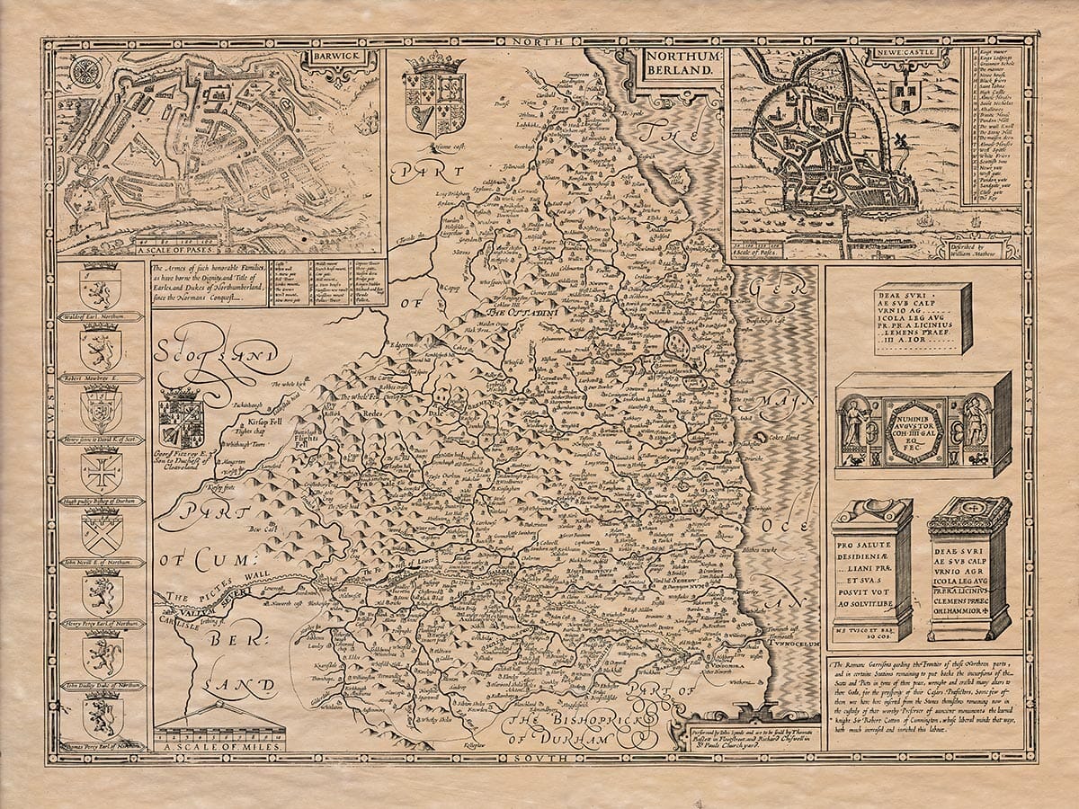
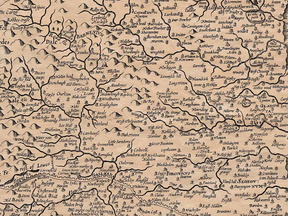
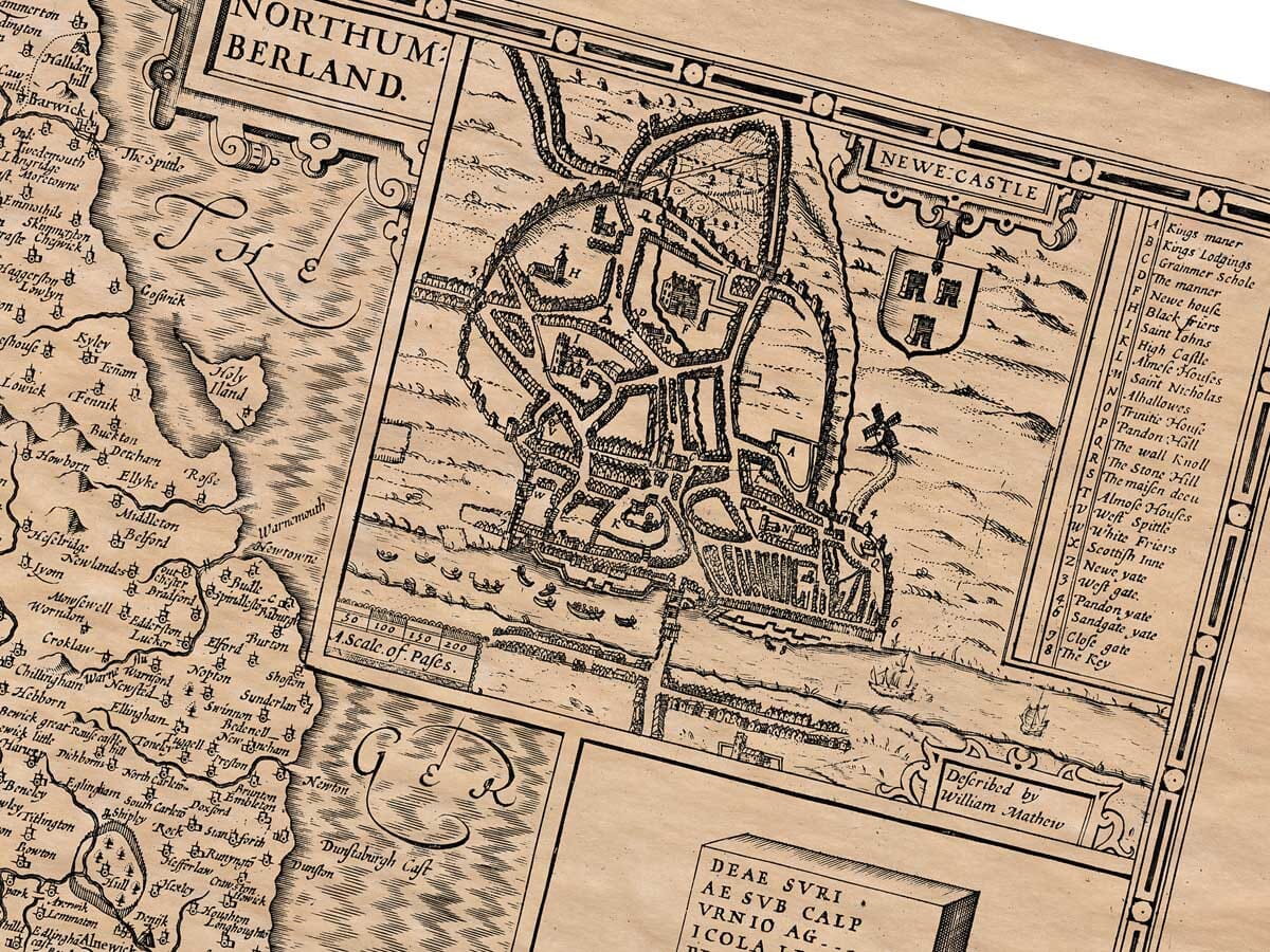
The Northumberland landscape spreads from the high country of the Pennines and Cheviots to the river area of the coastal plain. Newcastle was the most important and prosperous town of the area and is depicted in the top right part of the old map. There are many castles in Northumberland which were established as a defence on the border of the frontier with Scotland. The last major invasion from Scotland was in 1513 which was halted at Flodden field through the prompt action of Catherine of Aragon. Hadrian’s Wall is detailed as Picts Wall, still the more colloquial name. A fine example of John Speed’s early 17th Century UK maps.
Authentically aged heavy textured paper
12 Colour printing technology • Guaranteed to pass or exceed museum quality standards • Bespoke framing service • Free UK Courier Delivery with tracking
Available in three sizes: Large: 24″ x 31″(78.7 x 61cms) Medium: 18″ x 24″(45.5 x 61cms) Small: 19.5″ x 14″ (49.5 x 35.5cms)
Very impressed . . . exceeded my expectations. My son would now like one for Christmas!
Julia Ballester
Very pleased with the quality of the map and it even arrived before it was supposed too.
Nikki
Amazed to find the church where we married on a 400 year old map. Bought as a 1st anniversary gift.
K.H. Middlewhich
I am absolutely delighted with the my antique map. It is so interesting. I would now like to purchase another Map for my sister as a Christmas present.