


John Speed added geographical notes to the verso of his maps which we’ve translated into modern English
Location & Size
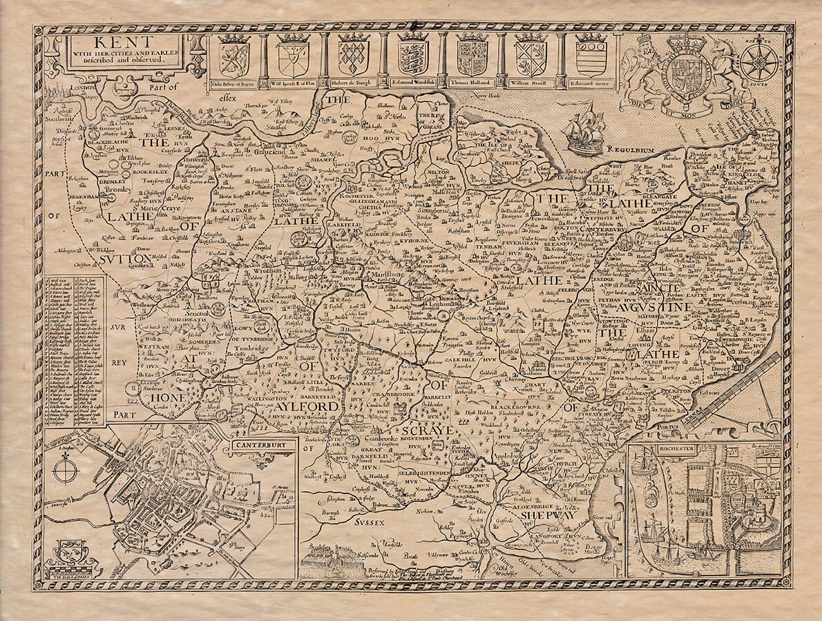
Kent is the first province encountered when entering England from the southeast, bordered by the Thames River to the north, the English Channel (formerly called the German Ocean) to the east and south, and Surrey and Sussex to the west. The county stretches about 53 miles east to west and roughly 26 miles north to south, with a total circumference of about 160 miles.
Shape & Geography
The county is shaped like a ham or a battle-axe and juts into the sea, forming a prominent coastal area. Notable sea-facing areas include the Isle of Sheppey, the cliffs of Dover, and Thanet Island. The land includes both flatlands and hills, with fertile valleys and woodland in the north and west, while the east and south tend to be chalkier and colder.
Soil & Resources
Kent has fertile soil in valleys and hills, producing crops, fruits, and grazing land for livestock. It has several mines—especially coal and iron—and is known for its abundance of natural resources. The rivers in Kent (such as the Medway) are navigable and used for transporting goods.
Rivers & Ports
Kent is well watered, and the rivers flow either directly to the sea or into the Thames. Important ports include Dover, Sandwich, Ramsgate, and Faversham. The county is known for having excellent harbor facilities and docks, supporting trade and travel.
Historical Names & Fortifications
The Romans called Kent “Cantium” or “Cantiaca Regio,” and they built many important structures here. Dover Castle, built by Julius Caesar and later enhanced by the Normans, was one of the earliest and most strategic Roman fortifications in England.
Dangers of the Sea
The Goodwin Sands, located off the northeast coast of Kent, are known for shipwrecks. These sandbanks are thought to have been part of the land owned by Earl Goodwin, which was submerged during a storm, creating dangerous shallows.
Inhabitants
In Roman times, the people of Kent were considered among the most civilized in Britain. They lived under their own kings and respected Roman rule. After the Saxons arrived, many Kentish people converted to Christianity, especially after the arrival of St. Augustine in 596 A.D. Kent was the first region in England to adopt Christianity.
Educational Importance
Kent became a centre of learning. The first English school of science and arts was established at Canterbury by St. Augustine. Over time, Kent was known for its bishops, monasteries, and scholars.
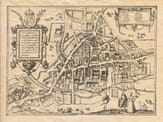
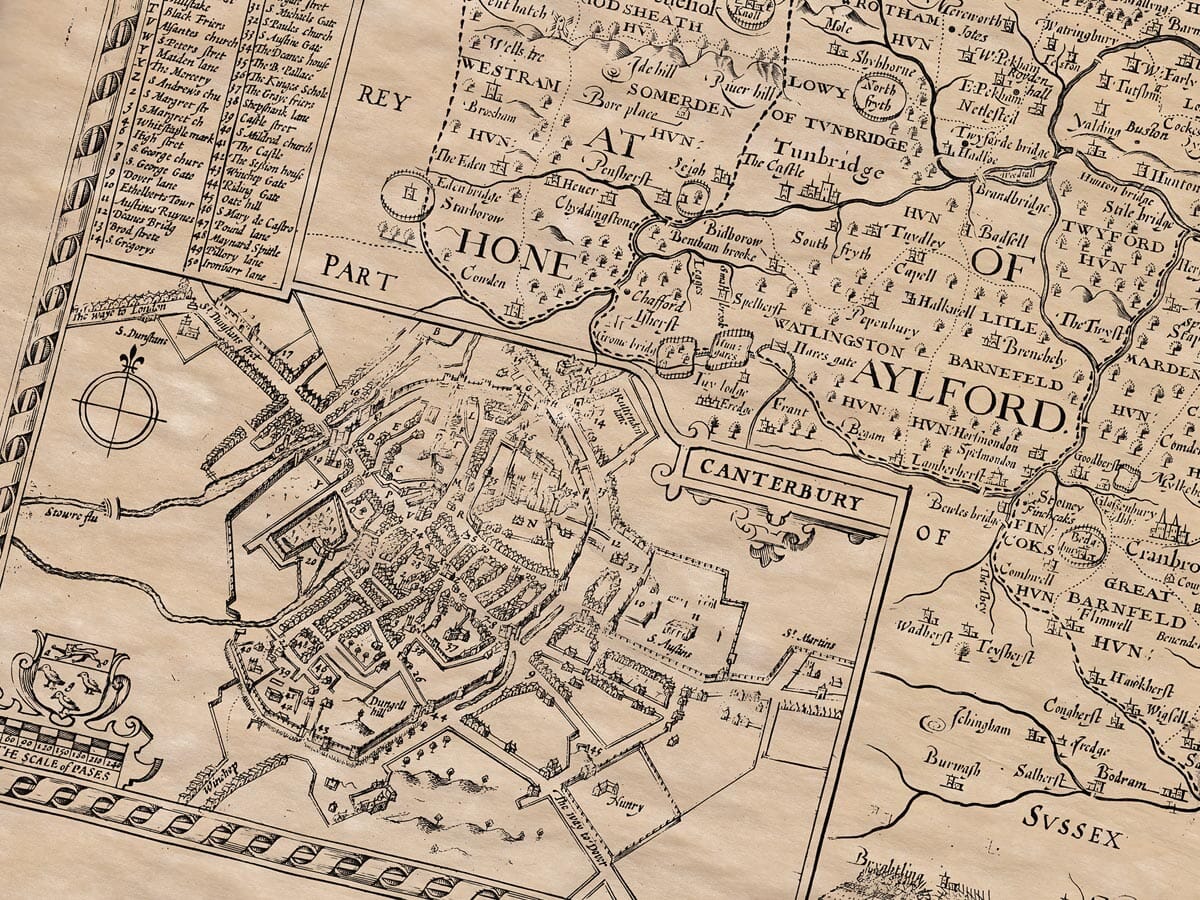
Major Cities
Canterbury . . . a town plan features within the old map, is the chief city and religious centre. It was built before the time of Christ, and became the seat of the Archbishop of Canterbury, who holds great influence over the English Church. Important historical events and burials occurred here, including those of King Henry IV and Queen Joan.
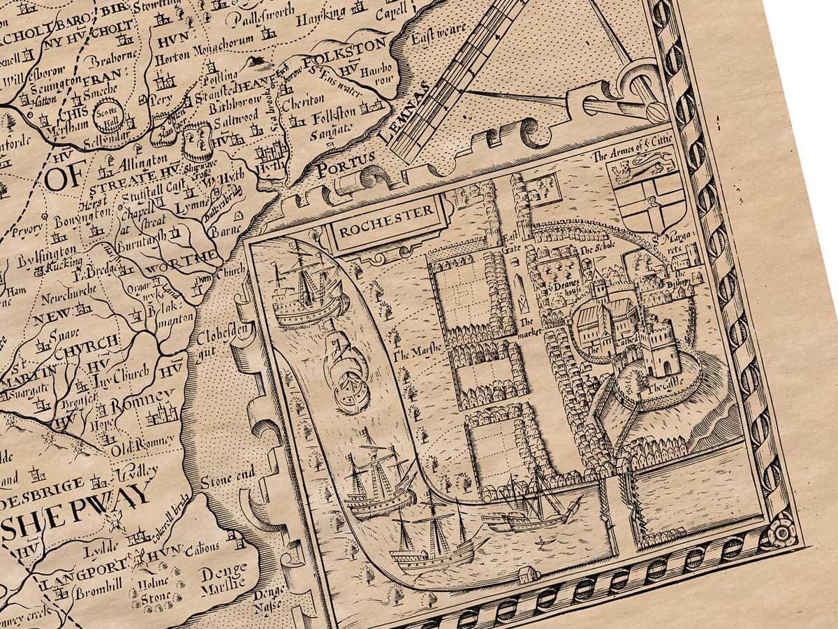
Military Significance
The city of Rochester, also in Kent, was heavily fortified and played key roles in battles against the Danes and during the reigns of several kings, including Henry III and Richard II. Castles and defensive walls protected the county from foreign attacks.
Civil Conflicts
Kent suffered much during civil wars and rebellions, including the Peasants’ Revolt, and conflicts under Kings Henry VI and Edward IV. The people of Kent were active in uprisings, including the one led by Jack Cade in 1450, and took part in various wars and power struggles.
Noble Families
Many noble families hailed from Kent, such as the Earls of Kent, and numerous important lineages settled here. The county was divided into five lathes (districts), twelve hundreds, and six dioceses, with at least twenty-three religious houses (monasteries and abbeys).

Speed’s geographical notes on the rear of the old map of Kent