Description
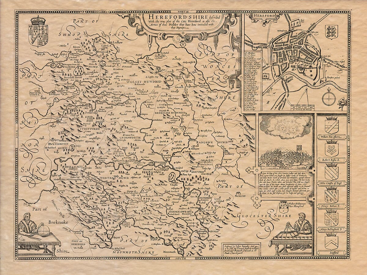
Old Map of Herefordshire . . . John Speed added geographical and historical notes to the verso of his maps. Here is a translation into modern English. The original page is pictured below.
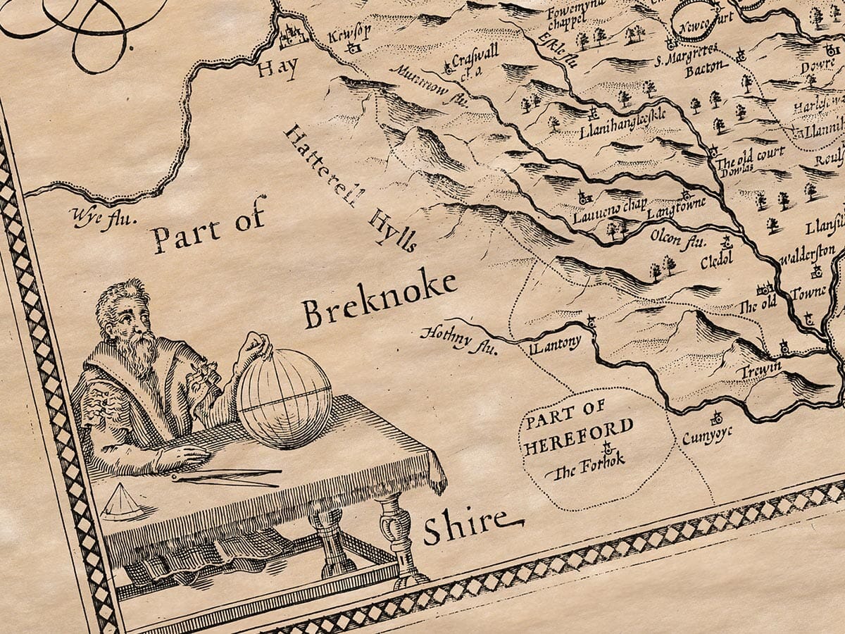
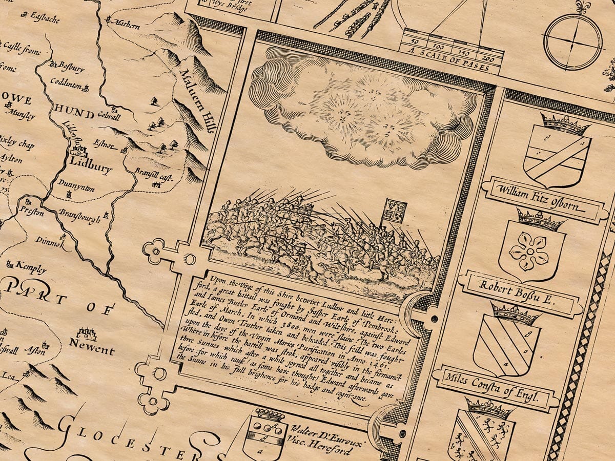
Herefordshire (formerly considered within the limits of Wales) lies bordered on the north by Worcestershire and Shropshire; on the east it is separated from Gloucestershire by the Malvern Hills; on the south it borders Monmouthshire; and on the west, the Hatterall Hills divide it from Brecknockshire, with the rest adjoining Radnorshire.
The climate of this county is very healthy and temperate, and the soil is so fertile for grain and livestock that no place in England produces more or better. Gentle rivers run like veins through the land, making some areas so productive that they are rightly called the “Golden Vale.” For water, wool, and wheat, it can compete with the Nile, Colchis, and Egypt. Such fertile places include Leominster and Irchenfield, along the banks of the Wye, Lugg, and Frome rivers.
The ancient people known to the Romans, who resisted fiercely before being subdued, were the Silures. Ptolemy placed them in this region, with branches extending into Radnorshire, Brecknockshire, Monmouthshire, and Glamorganshire — today called South Wales, and in Welsh “Deheubarth.” According to Tacitus, their dark complexions and curly hair suggested Spanish origin. Both he and Pliny describe them as fierce, brave, and unwilling to be enslaved. Under their leader Caratacus, they resisted the Romans for nine years. His eventual capture (through treachery) was considered in Rome a triumph worthy of note, as he had nearly matched the might of Rome with his own resistance. Roman historians always called it a dangerous war. The legion of Manlius Valens was driven back with heavy losses, and the Roman lieutenant Ostorius Scapula, grieving this defeat, soon died. Later, during the reign of Emperor Vespasian, the general Julius Frontinus finally subdued the Silures, forcing them under Roman control — though the Romans kept legions here for many years until the province was abandoned in the reign of Valentinian.
The Saxons later became lords of this land, making it part of the Mercian kingdom. Sutton became one of the royal seats.
The city of Hereford, once ruined by a violent earthquake, gained fame for the burial of King Ethelbert of the East Angles, slain by King Offa at Sutton. At the time of his death, Ethelbert was traveling to marry Offa’s daughter, but was treacherously killed. He was buried at Marden, later canonized as a saint, and his remains moved to Hereford. A church was built in his honour, which eventually became the cathedral. A fine old town plan of Hereford featured within the map.
In 1055, the city was attacked and burned by Gruffydd, Prince of South Wales, and Alfgar, an English earl rebelling against King Edward the Confessor. It was rebuilt by Bishop Reinelm, walled with six gates and watchtowers, and remains in good repair to this day.
The city’s greatest glory was its connection to King Æthelstan’s days, when, as the story goes, a man of Malmesbury refused to pay a tax of tribute in silver. To enforce it, the king had his land seized and made him pay twenty pounds in gold and three hundred pounds in silver — a story that was passed down for generations.
Things of unusual note in this shire include a place called Bone Well near the town of Ross, where the water continually brings up small bones — yet never a complete one — and they are perfectly clean. Nobody knows how or why they appear there.
Another remarkable event was the “wonder of God’s power” in our own time, in the year 1571. Near the village of Marcley Hill in the eastern part of the shire, the ground suddenly shifted with a great noise. A large section — about twenty acres — broke away from the hillside and slid into the valley below. Trees were uprooted, meadows overturned, and parts of the land sank while others were lifted up. Streams changed their course, a chapel was buried, and two highways were completely blocked. This strange event left the land permanently changed, and to this day the hill remains unstable.
This county also had many religious houses built by princes and noblemen. There were thirteen monasteries before the dissolution under King Henry VIII. Their lands and possessions were taken by the crown, and the monasteries themselves destroyed, along with the tombs and records of those buried there.
After the Norman Conquest, Herefordshire — once considered part of Wales — became a border stronghold. Castles were built to defend against the Welsh. At one time there were no fewer than twenty-eight, though many are now ruined. Among them were the castles of Albany, Eaton, Goodrich, Griffon, Hereford, Clifford, Brampton, Bredwardine, St. Briavels, and others.
The county is divided into eleven market towns and 176 parish churches, covering an area of 102 miles in circumference.

The verso of John Speed’s old map of Herefordshire c.161o