John Speed added a short essay which was published on the rear (the verso) of
his old map of Lancashire which we have translated into modern English . . .
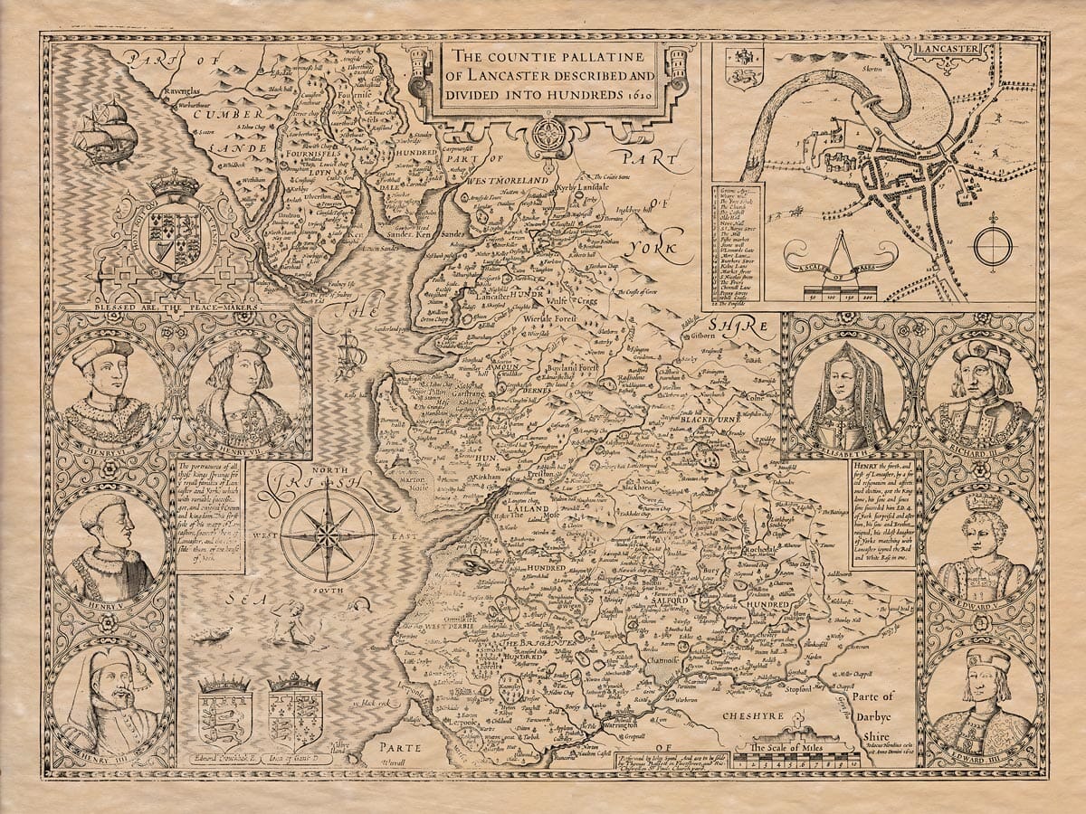
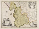
The Description of Lancashire
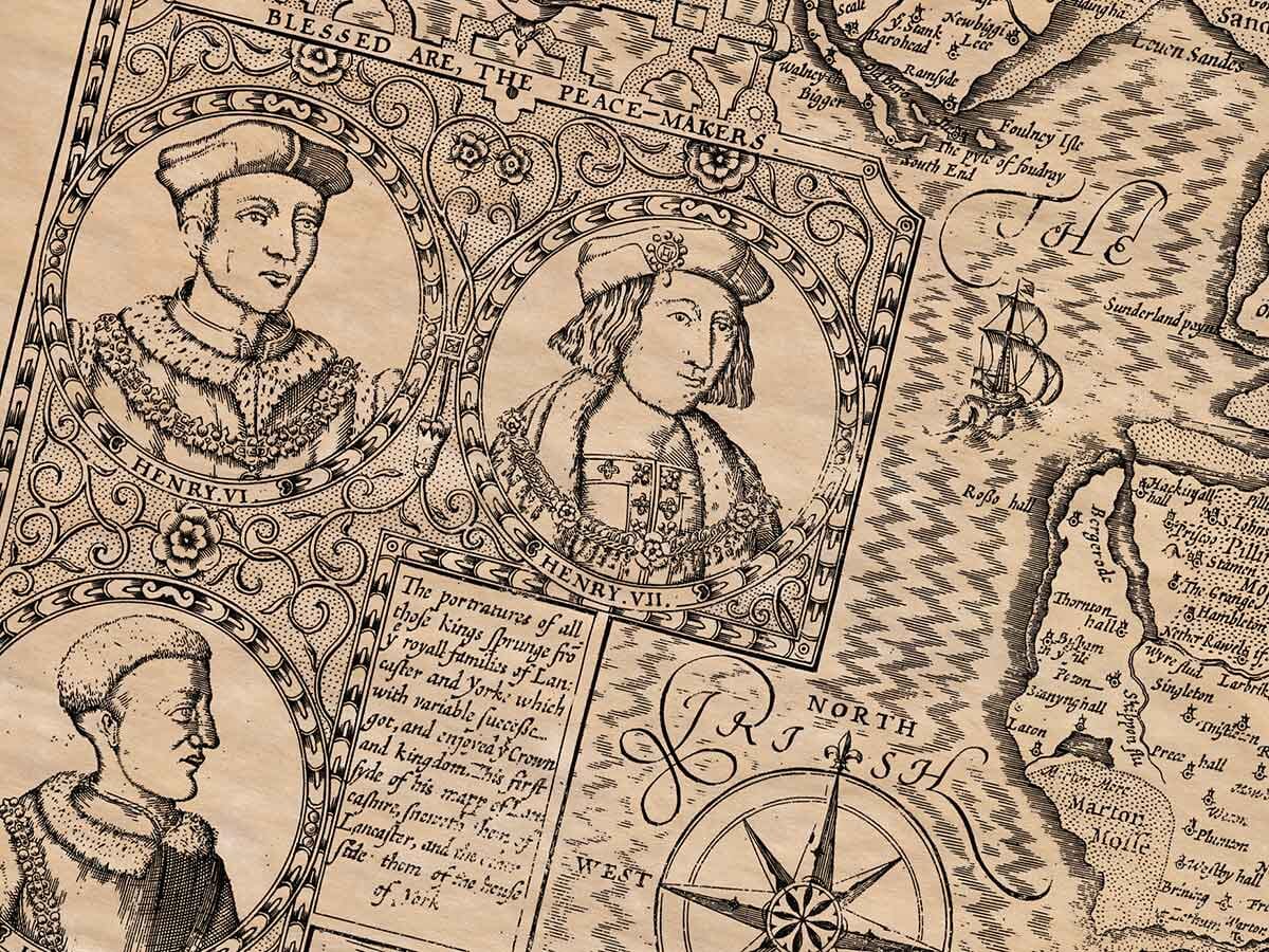
The County Palatine of Lancaster, known for producing the four Henrys (Kings Henry IV, V, VI, and VII), who descended from John of Gaunt, Duke of Lancaster, is located to the south, bordered by the River Mersey, which separates it from the County Palatine of Chester. To the east, it borders the beautiful County of Derbyshire, while the large county of Yorkshire lies to the north. The counties of Westmorland and Cumberland are also its neighbors to the north, and the Irish Sea embraces it to the west.
The county has a long, narrow shape. From its southern boundary, where it borders Cheshire, it is wider, but as it stretches northward, narrowing towards Westmorland. It measures 57 miles in length from Brathey in the north to Halwood in the south, and 31 miles from Denton in the east to Formby by Altcar in the west. The total circumference of the county is about 170 miles.
The air in this region is clear and fresh, not thick with fogs or vapors. As a result, the people here live long and healthily, rarely suffering from strange or unknown diseases.
The land, in general, is not highly fertile but produces large numbers of cattle, with impressive size and fine horns, rivaling the best in Spain. The county is rich in resources necessary for human life, including corn, flax, grass, coal, and similar products. The sea further adds to the prosperity, providing the population with an abundance of fish, meat, and poultry. Coal and turf are the main fuels, and the land is full of forests carefully preserved by the gentry, who view them as a beautifying feature of their estates. Though it is distant from London, the capital, the county sends thousands of cattle each year to various parts of the kingdom, demonstrating its blessed abundance.
The ancient inhabitants of this county were the Brigantes, who were conquered by the Romans under Emperor Claudius. The Romans established garrisons and made the area their base. There are many inscriptions and altars left by the Romans, indicating their presence. After the Romans, the Saxons took control, making it part of the Kingdom of Northumbria, until the Danes invaded, and later the Normans, who eventually expanded their influence over England.
Notable historical places in Lancashire include Manchester, which the Romans called Mancunium. It became a Roman fort and military station. Another important site is Riblechester, named after the Ribble River near Clithero. Although small, it was traditionally regarded as the wealthiest town in Christendom and was a Roman seat, with many Roman artifacts found in the area. Lancaster, the county town, is known for its beautiful location, and while not densely populated, it is notable for its castle, church, and bridge. King Edward III granted the town a mayor and officials, and it is governed by a mayor, two bailiffs, and other local officers.
The county experiences significant tidal forces, which can separate parts of the land from each other. For example, near Fournefs, the sea frequently disrupts the coastline with violent tides. Additionally, near Fournefs Fells, lies the largest standing body of water in England—Windermere—which stretches for ten miles. It is incredibly deep and has a stone-paved bottom. In several coastal areas, people create salt by pouring water onto sand piles, letting it develop a salty consistency, which they then boil with turf to produce salt.
Lancashire is protected by both natural barriers, such as the sea, and by many castles and fortifications that make it difficult for invaders to enter. It was one of the last regions to be fully subdued under the West Saxon monarchy.
Legend has it that King Arthur, who died with many trophies of honor, defeated the Saxons in a memorable battle near the small stream called Duglafs, near Wigan. However, the success of military campaigns in the area was uncertain, with leaders like Duke Wade suffering defeats, such as the one against Ardulph, King of Northumberland, at Billangho in 798. This uncertainty continued in the Civil Wars between the Houses of York and Lancaster, which caused bloody divisions in England for many years. These wars, with battles fought for years, saw the loss of many prominent figures, including kings, dukes, and barons. Eventually, the union of Henry VII (of Lancaster) with Elizabeth of York ended the conflict and brought about peace, marking the beginning of the Tudor dynasty. The county of Lancaster prospered under this new reign.
Four religious houses were established in the county, though they were later suppressed. These were Burgtogh, Whalleia, Holand, and Penwortham, all of which were known for their grand buildings and rich locations. The county is divided into six Hundreds, plus the Fournefs Fells and Lancaster’s Liberties in the northern part. It is home to 25 market towns, known for their beautiful locations and lively markets, and 26 parishes, in addition to chapels. The people of these towns are very active in attending divine services, making this area one of the most populous in the land.