Ancient Star Maps Print | 17th–18th Century Celestial Charts
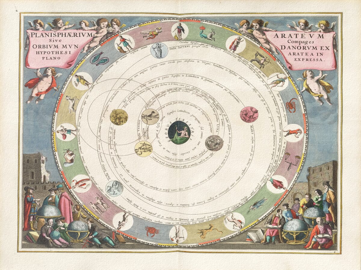
This fine star map dates back to a time when the sky was not thought of as empty space. It was seen as something structured, almost architectural, and studying this meticulously created chart reflects that idea. The circular design isn’t just decorative. It goes to represent how people believed the heavens moved around the Earth, slowly and predictably, night after night, year after year.
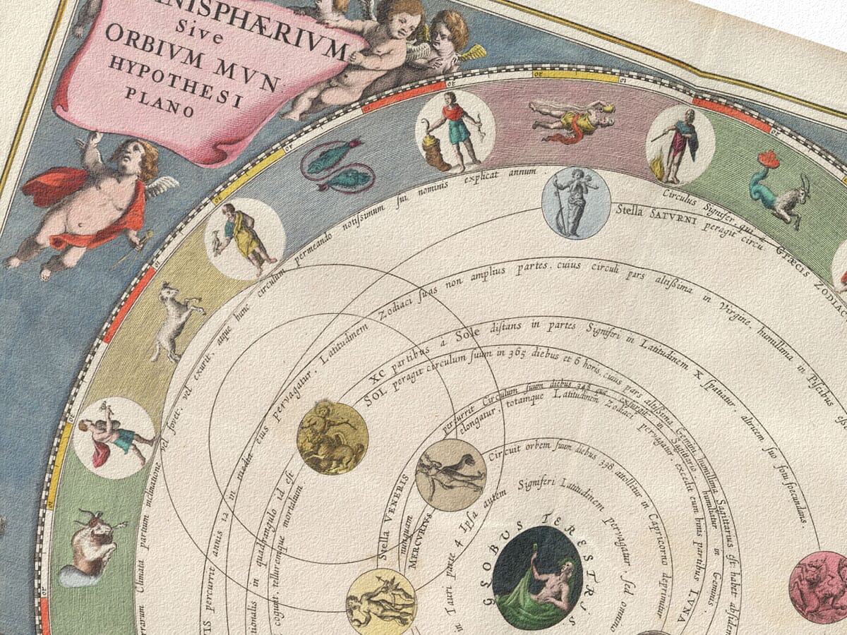
Note the zodiac constellations running around the outer edge of the map in a band. Whilst today we often think of the zodiac in purely symbolic terms, here it had a practical role. A further ring marks the path of the Sun through the year and how it helped connect the movement of the sky to the seasons, timekeeping, and everyday life. Looking at it now, it’s easy to forget how closely daily routines once followed the influence of the stars.
Inside that ring, the constellations appear as figures rather than patterns. The stars are there, but they’re arranged into characters drawn from classical stories. This wasn’t done just to decorate the map. It was an aid to understanding and remembering the night sky. Back then people learned the heavens through images and stories, not as we do via modern day coordinates.
Near the centre, faint circles suggest order and measurement. They don’t immediately explain themselves, and that’s part of the point. Early astronomy was not always about certainty. It was about trying to impose structure on something vast and difficult to grasp. The geometry hints at that effort.
Above the sky, figures appear in the clouds. They aren’t meant to be read literally. They reflect the idea that the heavens belonged to a higher order, something beyond ordinary experience. At the time, astronomy, philosophy, and belief weren’t separate fields, and hence the image doesn’t try to separate them.
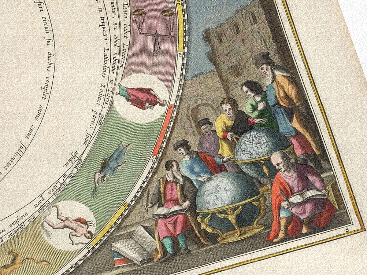
Below the stars are beautiful illustrations showing people studying instruments and globes. As well as works of art within themselves this detail is important historically as it reminds us that maps like this were made by real people who observed, argued, calculated, and sometimes disagreed. Knowledge came from work, not revelation.
The Latin text framing the image reinforces this. Latin was the language of learning, and its presence signals that this map was meant to be taken seriously. Even if the words aren’t read today, they still carry that weight.
Seen now, the map works in a quieter way. From a distance, it’s calm and balanced. Closer up, it’s dense and slightly strange. You don’t take it in all at once. You notice parts of it over time, and that’s probably how it was originally meant to be used.
What it shows, in the end, isn’t just the sky. It shows how people once tried to understand their place beneath it.